Difference between revisions of "User:Tomtom"
imported>Tomtom m (→successful attempts) |
imported>Tomtom (→regional geohash mission: Hungary) |
||
| Line 85: | Line 85: | ||
| bgcolor="#DFDFDF" |[[Győr, Hungary|Győr]]<BR />[http://irc.peeron.com/xkcd/map/map.html?lat=47&long=17&zoom=11&abs=1 «»] <BR />- / - | | bgcolor="#DFDFDF" |[[Győr, Hungary|Győr]]<BR />[http://irc.peeron.com/xkcd/map/map.html?lat=47&long=17&zoom=11&abs=1 «»] <BR />- / - | ||
| bgcolor="#DFDFDF" |[[Székesfehérvár, Hungary|Székesfehérvár]]<BR />[http://irc.peeron.com/xkcd/map/map.html?lat=47&long=18&zoom=11&abs=1 «»] <BR />- / - | | bgcolor="#DFDFDF" |[[Székesfehérvár, Hungary|Székesfehérvár]]<BR />[http://irc.peeron.com/xkcd/map/map.html?lat=47&long=18&zoom=11&abs=1 «»] <BR />- / - | ||
| − | | bgcolor="#99CCAA" |[[Budapest, Hungary|Budapest]]<BR />[http://irc.peeron.com/xkcd/map/map.html?lat=47&long=19&zoom=11&abs=1 «»] <BR /> | + | | bgcolor="#99CCAA" |[[Budapest, Hungary|Budapest]]<BR />[http://irc.peeron.com/xkcd/map/map.html?lat=47&long=19&zoom=11&abs=1 «»] <BR />9 / 2008.06.12. |
| bgcolor="#DFDFDF" |[[Szolnok, Hungary|Szolnok]]<BR />[http://irc.peeron.com/xkcd/map/map.html?lat=47&long=20&zoom=11&abs=1 «»] <BR />- / - | | bgcolor="#DFDFDF" |[[Szolnok, Hungary|Szolnok]]<BR />[http://irc.peeron.com/xkcd/map/map.html?lat=47&long=20&zoom=11&abs=1 «»] <BR />- / - | ||
| bgcolor="#DFDFDF" |[[Debrecen, Hungary|Debrecen]]<BR />[http://irc.peeron.com/xkcd/map/map.html?lat=47&long=21&zoom=11&abs=1 «»] <BR />- / - | | bgcolor="#DFDFDF" |[[Debrecen, Hungary|Debrecen]]<BR />[http://irc.peeron.com/xkcd/map/map.html?lat=47&long=21&zoom=11&abs=1 «»] <BR />- / - | ||
Revision as of 16:32, 11 November 2008
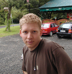
I am a zen buddhist geohasher monk.
I live and work in Dunakeszi, Hungary (Europe) which is inside the Budapest graticule (lat.47, lon.19).
I do not own a GPS device, so i use aerial photos, maps and my senses to locate geohashes.
successful attempts
2008.06.12. My first ever geohash, and probably the first one in Hungary. It was a muddy-shoes-and-soaked-trousers party with Demet.
2008.06.22. The lone-rider bicycle geohash to a small pine forest.
2008.06.29. A nice partially-bicycle geohash with Dem to the village where my Grandfather was born.
2008.07.27. A soft urban bike trip, some live music and nostalgia.
2008.07.29. A nice chatty walk with Dem, some hot chocolate, a pinpoint for meeting after her arrival back from LaRochelle, France and before her departure to Turkey soon. Plus the planning of The Ani DiFranco Expedition.
2008.07.31. The industrial and downtown lone-rider geohash, and hours in a bus stop shelter because of a heavy shower.
2008.08.14. A short expedition among litter and hookers.
2008.10.31. An almost-only-nature bike ride on a nearby island.
2008.11.11. The Dogwalk-geohash with my dog, Crux, to the hashpoint that was located our town.
notable failures
2008.06.14. The destination point of this day was in one of my favourite areas, easy to reach as well, but being the birthday of Kata, a very good friend of mine, i chose visiting her rather than the geohash.
2008.08.15. Geohash meetup point for this day in graticule lat.47 lon.17 is close to my favourite hill, Somló. (Best wines there.) but i still have some things to do and it will be quite late to start off there by the time i've finished.
2008.08.23. & 24. I was planning the defloration of the graticule lat.47 lon.17 with a nice weekend trip from one hashpoint to the other, but the evil Weather and Job intervened. These days are hard at work anyways.
2008.09.01. - 10.30. No time for geohashing period... BUT finally: over!
planned stuff
- visit a geohash location with my dog, Crux
- accomplish a geohash expedition by bike
 done. --Tom 22:18, 22 June 2008 (UTC)
- make a pilgrimage to the historical location of my date of birth (here),
or, as it is called now, to do the origin geohash
- complete the regional geohash of Hungary (see map below)
regional geohash mission: Hungary
| 16°E | 17°E | 18°E | 19°E | 20°E | 21°E | 22°E |
| 48°N |
| ||||||||||||||||||||||||||||
| 47°N | |||||||||||||||||||||||||||||
| 46°N | |||||||||||||||||||||||||||||
| 45°N |
legend:
           graticule name, (country)
           «» today's hash link
           sum of successful hashes /
           date of first successful expedition
achievements
This user earned the Bicycle geohash achievement
|
