Difference between revisions of "2008-06-15 47 -121"
From Geohashing
imported>Thomcat m |
imported>Thomcat |
||
| Line 33: | Line 33: | ||
Image:2008_06_15_47_-121_float.jpg|An abandoned float. | Image:2008_06_15_47_-121_float.jpg|An abandoned float. | ||
</gallery> | </gallery> | ||
| + | |||
| + | == Achievements == | ||
| + | {{#vardefine:ribbonwidth|800px}} | ||
| + | {{No trespassing |latitude= 47 |longitude= -121 |date= 2008-06-15 |image= 2008_06_15_47_-121_sign.jpg |name= Thomcat |distance= }} | ||
[[Category:Expeditions]] | [[Category:Expeditions]] | ||
Revision as of 18:40, 21 May 2013
| Sun 15 Jun 2008 in Snoqualmie: 47.4753808, -121.7612767 geohashing.info google osm bing/os kml crox |
About
Satellite wasn't that useful, so I scouted it myself. Turns out to be down a private drive in somebody's back yard.
Participants
Expeditions
Thomcat
A bright sunny morning on Father's day, and I've always wanted to take the 436th street exit for something. (Who counts 436 blocks from city center anyhow?)
Drove down a private drive and saw a young deer crossing between me and a barn, so I thought I'd try from the other side. More drive ways and roads, so I got as close as I could.
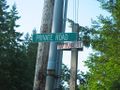
For Geohashers this is never a good sign
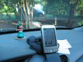
Closest point, one coordinate correct...
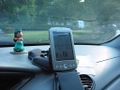
...and the other.


On the way back to the freeway, I passed this:
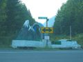
An abandoned float.

Achievements
Thomcat earned the No trespassing consolation prize
|