Difference between revisions of "2008-06-05 64 -149"
From Geohashing
imported>Joannac m (fix link) |
imported>Benjw (→Achievements: removing North geohash ribbon) |
||
| Line 31: | Line 31: | ||
| longitude = -149 | | longitude = -149 | ||
| date = 2008-06-05 | | date = 2008-06-05 | ||
| − | | name = Orbatos | + | | name = [[User:Orbatos|Orbatos]] |
| image = 080617 raptor 37.png | | image = 080617 raptor 37.png | ||
| − | |||
| − | |||
| − | |||
| − | |||
| − | |||
| − | |||
| − | |||
| − | |||
| − | |||
}} | }} | ||
Revision as of 14:22, 2 March 2009
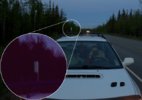
| Thu 5 Jun 2008 in Nenana, AK: 64.0664391, -149.1843892 geohashing.info google osm bing/os kml crox |
Contents
Logistics
- Google Maps link
- Middle of nowhere along the Parks Highway between Healey and Anderson.
- Looks obtainable. It's just off the road.
Intended Attendees
- Orbatos, Nutsenmai and Nycti are driving up to Fairbanks, AK Thursday and might attempt this one.
Execution/Aftermath
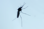
- Nutsenmai and Nycti were too tired to go trekking, and there was too great a presence of mosquitoes to warrant getting out of the car. They waited for the next hour or so wondering if raptors had eaten Orbatos.
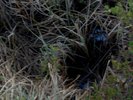
- We stopped just ahead of milepost 264 on the Parks Highway with the gps showing the destination coordinates as being 0.4 miles off-road. Orbatos decided to take an exploratory look and went offroad to find it goes steeply downhill and appeared too open up after the trees into a wide sparsely-treed knobby tundra. He went back to the car to retrieve the GPS and camera only to find the tundra degenerated into marsh after about 100 feet and quickly found himself wading for most of an hour until about 11:30pm, where he took a short panorama and and trudged back declaring a moratorium on bog, at least without proper gear.
Achievements
Photographic Evidence
- Orbatos' Expedition