Difference between revisions of "2020-05-19 39 -76"
From Geohashing
([live picture]The journey. [https://openstreetmap.org/?lat=39.76033040&lon=-76.23888790&zoom=16&layers=B000FTF @39.7603,-76.2389]) |
([live picture]Made it! Me with the Peach Bottom Atomic Energy Plant in the background. [https://openstreetmap.org/?lat=39.76376590&lon=-76.24091570&zoom=16&layers=B000FTF @39.7638,-76.2409]) |
||
| Line 38: | Line 38: | ||
Image:2020-05-19_39_-76_OfficeLinebacker_1589929481931.jpg|The journey. [https://openstreetmap.org/?lat=39.76033040&lon=-76.23888790&zoom=16&layers=B000FTF @39.7603,-76.2389] | Image:2020-05-19_39_-76_OfficeLinebacker_1589929481931.jpg|The journey. [https://openstreetmap.org/?lat=39.76033040&lon=-76.23888790&zoom=16&layers=B000FTF @39.7603,-76.2389] | ||
| + | |||
| + | Image:2020-05-19_39_-76_OfficeLinebacker_1589930411561.jpg|Made it! Me with the Peach Bottom Atomic Energy Plant in the background. [https://openstreetmap.org/?lat=39.76376590&lon=-76.24091570&zoom=16&layers=B000FTF @39.7638,-76.2409] | ||
</gallery> | </gallery> | ||
Revision as of 23:20, 19 May 2020
| Tue 19 May 2020 in 39,-76: 39.7638043, -76.2414042 geohashing.info google osm bing/os kml crox |
Location
Participants
Plans
Expedition
- I have to make this one my objective for the day. It is across the river from a nuclear power plant, and a couple miles up River from historic, scenic Port deposit Maryland. -- OfficeLinebacker (talk) @39.0931,-77.1554 10:32, 19 May 2020 (EDT)
Tracklog
Photos
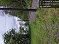
The journey. @39.7603,-76.2389

Made it! Me with the Peach Bottom Atomic Energy Plant in the background. @39.7638,-76.2409


Achievements