Difference between revisions of "2020-06-16 39 -77"
From Geohashing
([live] I had to park here, two and a half miles away, to gain the access I needed.) |
([live picture]Here we go. [https://openstreetmap.org/?lat=39.07242830&lon=-77.91172740&zoom=16&layers=B000FTF @39.0724,-77.9117]) |
||
| Line 38: | Line 38: | ||
--> | --> | ||
<gallery perrow="5"> | <gallery perrow="5"> | ||
| + | |||
| + | Image:2020-06-16_39_-77_OfficeLinebacker_1592343621920.jpg|Here we go. [https://openstreetmap.org/?lat=39.07242830&lon=-77.91172740&zoom=16&layers=B000FTF @39.0724,-77.9117] | ||
</gallery> | </gallery> | ||
Revision as of 21:40, 16 June 2020
| Tue 16 Jun 2020 in 39,-77: 39.0964922, -77.8818796 geohashing.info google osm bing/os kml crox |
Location
Participants
Plans
Expedition
- So this one is going to be very complicated because it's right next to the Appalachian trail but there's a lot of private property to the Appalachian trail so access is complicated -- OfficeLinebacker (talk) @39.0991,-77.9020 17:28, 16 June 2020 (EDT)
- I had to park here, two and a half miles away, to gain the access I needed. -- OfficeLinebacker (talk) @39.0728,-77.9127 17:37, 16 June 2020 (EDT)
Tracklog
Photos
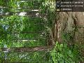
Here we go. @39.0724,-77.9117

Achievements