Difference between revisions of "2020-07-11 32 -116"
From Geohashing
m (→Location) |
(Remove Expedition text) |
||
| Line 27: | Line 27: | ||
<!-- how it all turned out. your narrative goes here. --> | <!-- how it all turned out. your narrative goes here. --> | ||
| − | |||
| − | |||
== Tracklog == | == Tracklog == | ||
<!-- if your GPS device keeps a log, you may post a link here --> | <!-- if your GPS device keeps a log, you may post a link here --> | ||
Revision as of 16:05, 10 July 2020
| Sat 11 Jul 2020 in 32,-116: 32.8637221, -116.4672808 geohashing.info google osm bing/os kml crox |
Location
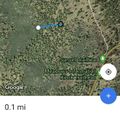
About 1/10th of a mile off trail in the Cleveland National Forest near the Sunset Trailhead off Sunrise Highway.
Participants
Plans
Expedition
Tracklog
Photos
- This expedition is in the Cleveland National Forest about 1/10th of a mile from the Sunset Trail and about 1/3 of a mile from the trailhead at Sunrise Highway. Parking and portable bathrooms are available on site but no water.
- If you are interested please contact me so we can plan a socially distant meetup.
Achievements
