Difference between revisions of "2008-07-16 47 9"
From Geohashing
imported>Till (New page: {{meetup graticule | map=<map lat="47" lon="9" date="2008-07-16" /> | lat=47 | lon=9 | date=2008-07-16 | graticule_name=Lake of Constance | graticule_link=47,9 }} == Till == ...) |
imported>Till |
||
| Line 5: | Line 5: | ||
| date=2008-07-16 | | date=2008-07-16 | ||
| graticule_name=Lake of Constance | | graticule_name=Lake of Constance | ||
| − | | graticule_link= | + | | graticule_link=Lake of Constance |
}} | }} | ||
== [[User:Till|Till]] == | == [[User:Till|Till]] == | ||
Revision as of 11:50, 20 July 2008
| Wed 16 Jul 2008 in Lake of Constance: 47.7884753, 9.2828229 geohashing.info google osm bing/os kml crox |
Till
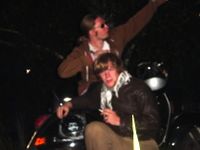
We did it because it was easy. My graticule includes three countries and is divided by a huge lake, so when a point shows up 10km from your home, you go there. Plus the point was actually on a small, barely used road, so it was a small effort to get there. I brought a friend, whom i was unable to explain to why on earth we were doing this, we took his scooter to get there, left a note, took two pictures (thanks for stealing the focus, leaf, and thanks for dying 10 seconds later, battery), had a smoke and left. As expected we found no signs of previous visitors.

