Difference between revisions of "2023-12-31 47 -122"
From Geohashing
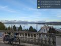
Coyotebush (talk | contribs) ([live picture]Best Rainier view of the day [https://openstreetmap.org/?mlat=47.61385833&mlon=-122.28136667&zoom=16 @47.6139,-122.2814]) |
Coyotebush (talk | contribs) ([live picture]Best GPS reading) |
||
| Line 62: | Line 62: | ||
Image:2023-12-31_47_-122_coyotebush_1704072788987.jpg|Best Rainier view of the day [https://openstreetmap.org/?mlat=47.61385833&mlon=-122.28136667&zoom=16 @47.6139,-122.2814] | Image:2023-12-31_47_-122_coyotebush_1704072788987.jpg|Best Rainier view of the day [https://openstreetmap.org/?mlat=47.61385833&mlon=-122.28136667&zoom=16 @47.6139,-122.2814] | ||
| + | |||
| + | Image:2023-12-31_47_-122_coyotebush_1704072923495.jpg|Best GPS reading | ||
</gallery> | </gallery> | ||
Revision as of 01:35, 1 January 2024
| Sun 31 Dec 2023 in 47,-122: 47.5988040, -122.2919734 geohashing.info google osm bing/os kml crox |
Location
Frink Park in the Leschi neighborhood.
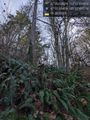
Close to a trail, but the hillside is steep and the vegetation is dense.
Participants
Plans
Perhaps mid-afternoon?
Expedition
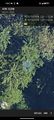
Tracklog
Photos
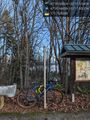
Parked bike at top of hill @47.5991,-122.2925
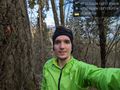
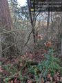
It's near this tree @47.5989,-122.2920
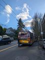
Trolleybus trouble blocking traffic
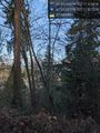
From trail above @47.5988,-122.2921
From trail below @47.5989,-122.2916
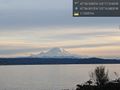
Nearby view towards Mt Rainier @47.5982,-122.2920
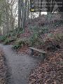
Handy bench @47.5995,-122.2923
Halfway from trail to tree @47.5987,-122.2918
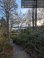
Viewpoint over Lake Washington @47.5904,-122.2889
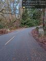
Road through Frink Park @47.5992,-122.2907
Best Rainier view of the day @47.6139,-122.2814
Best GPS reading


Achievements