File:2008-10-13 59-10.jpg
From Geohashing
Revision as of 07:19, 11 February 2010 by imported>AperfectBot (Ook!)

Size of this preview: 800 × 353 pixels. Other resolutions: 320 × 141 pixels | 816 × 360 pixels.
Original file (816 × 360 pixels, file size: 109 KB, MIME type: image/jpeg)
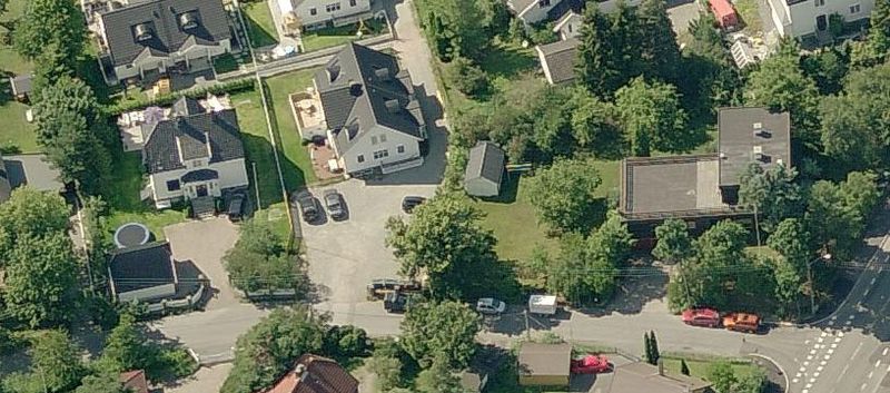
Aerial of the area of the 59-10 geohash at 2008-10-13. The Hash-point is at the garage in the left of the picture. The large flat-roofed building to the right is now gone, and new development is in progress.
File history
Click on a date/time to view the file as it appeared at that time.
| Date/Time | Thumbnail | Dimensions | User | Comment | |
|---|---|---|---|---|---|
| current | 14:42, 30 January 2020 | | 816 × 360 (109 KB) | Maintenance script (talk | contribs) |
- You cannot overwrite this file.
File usage
The following page links to this file: