File:2009-12-25 42 -72 map.jpg
From Geohashing
Revision as of 14:41, 27 December 2009 by imported>Guinea-pig

Size of this preview: 800 × 529 pixels. Other resolutions: 320 × 212 pixels | 868 × 574 pixels.
Original file (868 × 574 pixels, file size: 95 KB, MIME type: image/jpeg)
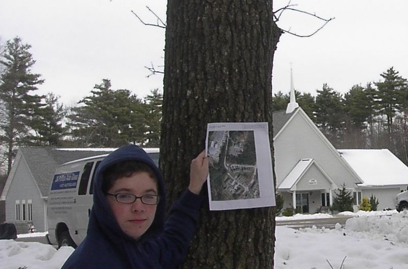
Chedrania holding up the google maps "satellite view" printout of the hashpoint, standing at approximately where the marker on the map is.
File history
Click on a date/time to view the file as it appeared at that time.
| Date/Time | Thumbnail | Dimensions | User | Comment | |
|---|---|---|---|---|---|
| current | 16:51, 30 January 2020 | | 868 × 574 (95 KB) | Maintenance script (talk | contribs) |
- You cannot overwrite this file.
File usage
The following page links to this file: