File:20110913 53-1 03 Locality.png
From Geohashing
Revision as of 14:34, 30 January 2020 by Maintenance script (talk | contribs) (Maintenance script uploaded File:20110913 53-1 03 Locality.png)
No higher resolution available.
20110913_53-1_03_Locality.png (640 × 480 pixels, file size: 557 KB, MIME type: image/png)
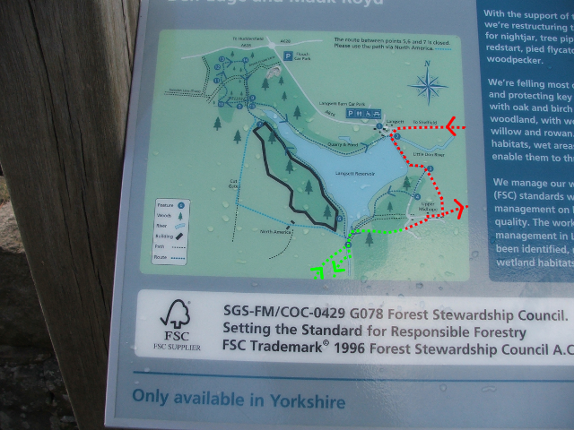
Local signage. Annotated to show the routes driven (in red) and walked (in green) across this particular map's field of view.
File history
Click on a date/time to view the file as it appeared at that time.
| Date/Time | Thumbnail | Dimensions | User | Comment | |
|---|---|---|---|---|---|
| current | 14:34, 30 January 2020 | | 640 × 480 (557 KB) | Maintenance script (talk | contribs) |
- You cannot overwrite this file.
File usage
The following page links to this file: