2011-12-23 -37 145
From Geohashing
Revision as of 19:44, 22 December 2011 by imported>Kozz (→Location)
| Fri 23 Dec 2011 in -37,145: -37.7899611, 145.0375325 geohashing.info google osm bing/os kml crox |
Location
Kozz - by the looks of things, just north of the Eastern Freeway bike path, about 1km east of the Chandler Highway. Easily accessible by bike. TAlex has already been there so may be able to shed some light when awake.
Participants
Plans
Talex rolled on out there first thing in the morning. Like, literally first thing, in literally the morning. Literally.
Kozz is planning to head there middayish (the -ish bit being the operative word). It looks like it's on the river bank, but from Talex's photos it may be out in the midst of the river? If it's on the golf course...well....things might have to get a bit golfy this afternoon.
Expedition
- Night time hash success! No sleep for ne tonight.... -- Talex @-37.7900,145.0375 02:05, 23 December 2011 (GMT+10:00)
Tracklog
Photos
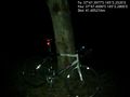
Trusty steed @-37.7900,145.0380
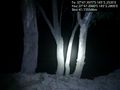
Scenic river views from the hash point, this would be really nice in the day :) @-37.7899,145.0380


Achievements