2012-10-08 47 -122
From Geohashing
Revision as of 01:39, 9 October 2012 by imported>Nokoose (→Plans)
| Mon 8 Oct 2012 in 47,-122: 47.0565762, -122.4743572 geohashing.info google osm bing/os kml crox |
Location
Has location was on the ground of Joint Base Lewis McChord, not accessible to the public
Participants
Nokoose
Plans
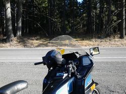
This being my first actual geohash attempt, I went off knowing I would fail to reach the actual coordinates. Rode out from Lakewood, hoping to get as close as possible to the actual hash knowing I couldn't actually reach it legally. But any excuse for a ride in good weather is good enough. went to the closest safe pull off point, parked the bike snapped a quick pic, rode off again.
Expedition
Tracklog
Photos
Achievements
