2013-03-28 38 -76
| Thu 28 Mar 2013 in 38,-76: 38.6717396, -76.1702692 geohashing.info google osm bing/os kml crox |
Location
Participants
Plans
Expedition
Set out from Rockville at about 9:50. This was fairly straightforward as the GPS took me right to the driveway of the park. Once I got inside I detoured based on my own survey because the GPS would not have taken me to the closest parking lot. Once I arrived I realized that the vehicles I saw on the satellite pic are not buses of schoolchildren as I thought, but RVs. They rent out the lot to RV owners. It's a very desirable spot. I talked to a guy who said he was on a waiting list for three years.
There is also temporary (only during the offseason) storage right next to it.
I parked the car next to a pile of firewood and set off into the woods. There was a path which I should have used because even though it was windy, it would have taken me very close to the spot. Once I realized this I got on the path. A fallen tree which formed a bridge over a ravine showed the way to the exact location so I crossed it and took my pictures. Nice little location.
The GPS wasn't very exact and kept shifting accuracy but I am reasonably confident that at one point I was within a few feet of the exact spot.
Once I finished, I decided to head to the geohash for the next graticule over.
Tracklog
Photos

Silly grin @38.6718,-76.1703
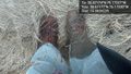
My boots @38.6718,-76.1703


Achievements