File:2015-06-28 50 19-location4.png
From Geohashing
Revision as of 13:49, 29 June 2015 by imported>Malgond (Distance to geohash from paved road. Category: Meetup on 2015-03-22 Category: Meetup in 50 20)
No higher resolution available.
2015-06-28_50_19-location4.png (502 × 435 pixels, file size: 82 KB, MIME type: image/png)
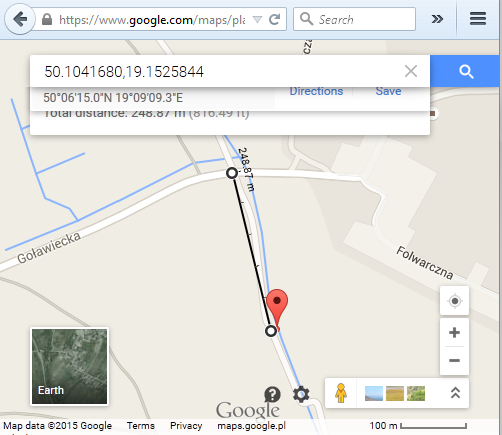
Distance to geohash from paved road.
File history
Click on a date/time to view the file as it appeared at that time.
| Date/Time | Thumbnail | Dimensions | User | Comment | |
|---|---|---|---|---|---|
| current | 16:13, 30 January 2020 | | 502 × 435 (82 KB) | Maintenance script (talk | contribs) |
- You cannot overwrite this file.
File usage
The following page links to this file: