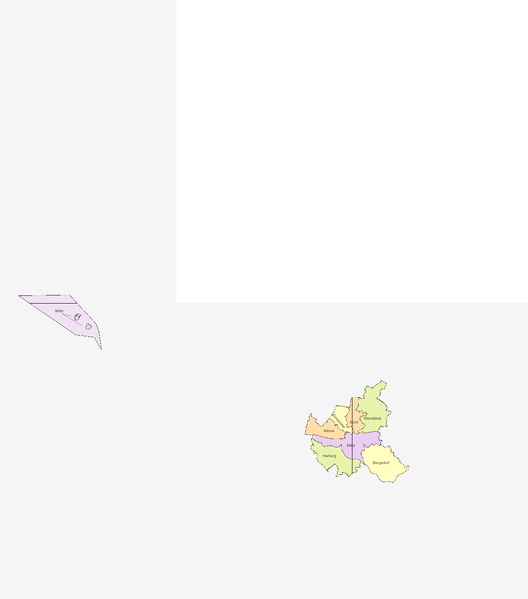
File:Regional Map Hamburg, Germany Districts.svg
From Geohashing
Revision as of 15:33, 25 August 2022 by Leidenfrost (talk | contribs) (Leidenfrost uploaded a new version of File:Regional Map Hamburg, Germany Districts.svg)

Size of this PNG preview of this SVG file: 528 × 599 pixels. Other resolution: 211 × 240 pixels.
Original file (SVG file, nominally 1,224 × 1,389 pixels, file size: 97 KB)
Summary
53,8; 53,9; 53,10 include land; 54,8 includes only waters
File history
Click on a date/time to view the file as it appeared at that time.
| Date/Time | Thumbnail | Dimensions | User | Comment | |
|---|---|---|---|---|---|
| current | 15:33, 25 August 2022 | | 1,224 × 1,389 (97 KB) | Leidenfrost (talk | contribs) | h/2 |
| 15:32, 25 August 2022 | Error creating thumbnail: convert: unable to extend cache '/tmp/magick-c9OkuHi3lU4LJuP2i89y76PtxN5Y6lKW': File too large @ error/cache.c/OpenPixelCache/3901.
convert: no images defined `PNG:/tmp/transform_04f67f2de773.png' @ error/convert.c/ConvertImageCommand/3325.
| 2,449 × 2,778 (97 KB) | Leidenfrost (talk | contribs) | h/2 | |
| 15:31, 25 August 2022 | Error creating thumbnail: convert: unable to extend cache '/tmp/magick-REdrVlPTW93mUq3TFozgp2DMOjUkcV8m': File too large @ error/cache.c/OpenPixelCache/3901.
convert: no images defined `PNG:/tmp/transform_c2a5444eac52.png' @ error/convert.c/ConvertImageCommand/3325.
| 4,957 × 5,624 (97 KB) | Leidenfrost (talk | contribs) | 53,8; 53,9; 53,10 include land; 54,8 includes only waters |
- You cannot overwrite this file.
File usage
There are no pages that link to this file.