Category:Maps
From Geohashing
Media in category "Maps"
The following 200 files are in this category, out of 620 total.
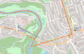
(previous page) (next page) Macronencer Journal 2020-03-18 01.png 332 × 264; 161 KB
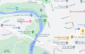
 Macronencer Journal 2020-03-18 02.png 719 × 606; 188 KB
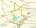
 Macronencer map 032.png 789 × 750; 1,017 KB
 Macronencer map 034.png 693 × 478; 559 KB
 Macronencer map 036.png 681 × 516; 588 KB
 Macronencer map 039.png 588 × 471; 482 KB
 Macronencer map 041.png 563 × 479; 512 KB
 Macronencer map 045.png 459 × 633; 422 KB
 Macronencer map 25.png 481 × 446; 270 KB
 Map of Wisconsin highlighting Marathon County.png 224 × 240; 21 KB
 Map-hybrid-2008-12-18.JPG 687 × 630; 74 KB
 Map-karttapaikka.png 600 × 600; 58 KB
 Map.jpg 758 × 529; 42 KB
 Michael5000 Home States Map 2011-07-28.jpg 997 × 1,246; 374 KB
 Michael5000 Home States Map 2011-07-31.jpg 997 × 1,246; 372 KB
 MilwaukeeGraticule.gif 501 × 600; 39 KB
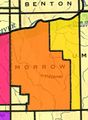 Morrow County.JPG 468 × 640; 55 KB
 MP072408-Rough.jpg 973 × 470; 122 KB
 MSP Graticules.png 370 × 522; 41 KB
 MSP.PNG 370 × 522; 41 KB
 My Path.jpg 532 × 357; 49 KB
 Districts of Regierungsbezirk Münster.jpg 1,528 × 1,080; 177 KB
 Münster regional.svg 126 × 400; 38 KB
 N39.576378 W76.158378.jpg 1,030 × 585; 167 KB
 Ncbears xkcd regions 05 02 09.png 216 × 162; 2 KB
 Ncbears xkcdregion.png 216 × 162; 2 KB
 Nemo geohash visits.jpg 440 × 394; 99 KB
 European Netherlands regional.png 3,090 × 4,000; 332 KB
 European Netherlands regional.svg 0 × 0; 2.29 MB
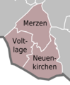 Municipalities of Samtgemeinde Neuenkirchen.png 490 × 596; 50 KB
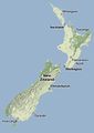 New Zealand.JPG 293 × 412; 13 KB
 Niedersachsen regional.svg 486 × 400; 769 KB
 NOLA Graticule.PNG 732 × 840; 265 KB
 Governmental Districts of Nordrhein-Westfalen.jpg 1,000 × 994; 103 KB
 Nordrhein-Westfalen regional.svg 415 × 400; 773 KB
 Norfolk colour.PNG 458 × 705; 34 KB
 NoRoad.jpg 2,592 × 1,944; 1.78 MB
 Oregon & Washington Geohashing Map 2022-03-06.jpg 1,320 × 1,685; 398 KB
 Oregon & Washington Geohashing Map 2022-06-12.jpg 1,320 × 1,685; 396 KB
 Oregon & Washington Geohashing Map 2023-01-11.jpg 1,320 × 1,685; 414 KB
 Oregon & Washington Geohashing Map 2023-05-02.jpg 1,320 × 1,685; 418 KB
 Oregon & Washington Geohashing Map 2023-12-31.jpg 1,320 × 1,685; 420 KB
 Oregon Washington Geohashing Map 2011-08-06.jpg 997 × 1,246; 369 KB
 Oregon Washington Geohashing Map 2011-08-14.jpg 997 × 1,246; 370 KB
 Oregon Washington Geohashing Map 2011-09-24.jpg 997 × 1,246; 370 KB
 Oregon Washington Geohashing Map 2011-10-15.jpg 997 × 1,246; 369 KB
 Oregon Washington Geohashing Map 2012-01-15.jpg 997 × 1,246; 368 KB
 Oregon Washington Geohashing Map 2012-04-06.jpg 997 × 1,246; 370 KB
 Oregon Washington Geohashing Map 2012-07-28.jpg 997 × 1,246; 208 KB
 Oregon Washington Geohashing Map 2012-08-03.jpg 997 × 1,246; 207 KB
 Oregon Washington Geohashing Map 2012-12-29.jpg 997 × 1,246; 207 KB
 Oregon Washington Geohashing Map 2014-02-03.jpg 997 × 1,246; 207 KB
 Oregon Washington Geohashing Map 2014-06-14.jpg 997 × 1,246; 207 KB
 Oregon Washington Geohashing Map 2014-06-15.jpg 997 × 1,246; 206 KB
 Oregon Washington Geohashing Map 2014-06-27.jpg 997 × 1,246; 206 KB
 Oregon Washington Geohashing Map 2018-11-25.jpg 997 × 1,246; 204 KB
 Oregon Washington Geohashing Map 2018-12-15.jpg 997 × 1,246; 205 KB
 Oregon Washington Geohashing Map 2019-03-24.jpg 997 × 1,246; 204 KB
 Oregon Washington Geohashing Map 2019-06-29.jpg 997 × 1,246; 204 KB
 Oregon Washington Geohashing Map 2019-08-04.jpg 997 × 1,246; 206 KB
 Osnabrück regional.svg 486 × 400; 24 KB
 Municipalities of Landkreis Peine.png 1,000 × 943; 199 KB
 Pittsburgh Graticules.png 730 × 481; 201 KB
 Porta Westfalica regional.svg 486 × 400; 24 KB
 Portland Sample Coord.png 961 × 660; 192 KB
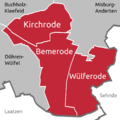 Quarters of Kirchrode-Bemerode-Wülferode.png 1,050 × 1,050; 141 KB
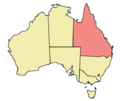 Queensland locator-MJC.png 563 × 476; 12 KB
 Raleigh Graticule Thumb.png 448 × 240; 272 KB
 Raptors!.jpg 705 × 417; 64 KB
 RedHatter-geomap.png 500 × 500; 80 KB
 Regierungsbezirk Arnsberg regional.svg 253 × 400; 324 KB
 Regierungsbezirk Braunschweig regional.svg 370 × 400; 243 KB
 Regierungsbezirk Detmold regional.svg 248 × 400; 271 KB
 Regierungsbezirk Düsseldorf regional.svg 744 × 400; 275 KB
 Regierungsbezirk Hannover regional.svg 245 × 400; 232 KB
 Regierungsbezirk Köln regional.svg 378 × 400; 470 KB
 Regierungsbezirk Lüneburg regional.svg 481 × 400; 178 KB
 Regierungsbezirk Münster regional.svg 370 × 400; 312 KB
 Regierungsbezirk Weser-Ems regional.svg 361 × 400; 268 KB
 Regiohash Hessophanes.png 232 × 242; 3 KB
 Region 35,-105 Admin 6.svg 896 × 1,100; 6 KB
 Region 35,-106 Admin 6.svg 896 × 1,100; 57 KB
 Region 47,10 Admin 4.svg 1,877 × 2,778; 868 KB
 Region 47,13 Admin 4.svg 1,877 × 2,778; 212 KB
 Region 48,9 Admin 4.svg 1,841 × 2,778; 10 KB
 Region 49,7 Admin 4.svg 1,804 × 2,778; 270 KB
 Region 50,11 Admin 4.svg 1,767 × 2,778; 300 KB
 Region 50,12 Admin 4.svg 1,767 × 2,778; 688 KB
 Region 50,8 Admin 4.svg 1,768 × 2,778; 75 KB
 Region 50,9 Admin 4.svg 1,449 × 2,278; 114 KB
 Region 51,13 Admin 4.svg 1,730 × 2,778; 60 KB
 Region 53,10 Admin 4.svg 1,652 × 2,778; 219 KB
 Region 53,11 Admin 4.svg 1,654 × 2,778; 129 KB
 Region 53,14 Admin 4.svg 1,654 × 2,778; 638 KB
 Region 53,8 Admin 4.svg 1,652 × 2,778; 215 KB
 Region 53,9 Admin 4.svg 1,652 × 2,778; 97 KB
 Region 54,10 Admin 4.svg 1,614 × 2,778; 243 KB
 Region 54,11 Admin 4.svg 1,614 × 2,778; 378 KB
 Region 54,7 Admin 4.svg 1,613 × 2,778; 20 KB
 Region 54,8 Admin 4.svg 1,613 × 2,778; 132 KB
 Region 54,9 Admin 4.svg 1,614 × 2,778; 120 KB
 Region 55,8 Admin 2.svg 1,573 × 2,778; 352 KB
 Region 55,8 Admin 4.svg 1,571 × 2,778; 234 KB
 Region Hannover regional.svg 486 × 400; 84 KB
 Regional Map Hamburg, Germany Districts.svg 1,224 × 1,389; 97 KB
 Regionalhashing.png 749 × 966; 331 KB
 Regions 48 11.png 393 × 620; 228 KB
 Regions of -36 174 Auckland Graticule.JPG 682 × 678; 79 KB
 Reinhard Germanymap.jpg 508 × 592; 209 KB
 Reinhard Worldmap.jpg 635 × 369; 101 KB
 ReletRegioBrandenburg.png 232 × 242; 4 KB
 RHMH1-01-20-2009Map.jpg 1,152 × 864; 181 KB
 RHMH2-07-20-1969Map.jpg 1,152 × 864; 176 KB
 RHMH3-05-11-2001Map.jpg 1,152 × 864; 167 KB
 RHMH4-12-07-1941Map.jpg 1,152 × 864; 179 KB
 RHMH5-08-06-1945Map.jpg 1,152 × 864; 200 KB
 Riding range.jpg 734 × 880; 206 KB
- Error creating thumbnail: Unable to save thumbnail to destinationRiesensteinpfad.jpg 908 × 615; 183 KB
 Rumeli.png 730 × 975; 246 KB
 Sachsen regional.svg 627 × 400; 870 KB
 Samtgemeinde Artland regional.svg 486 × 400; 12 KB
 Samtgemeinde Bersenbrück regional.svg 486 × 400; 11 KB
 SanDiego-WrapMethod.jpg 404 × 386; 93 KB
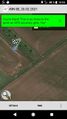 Santu 210220 3.jpg 405 × 720; 111 KB
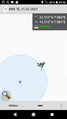 Santu 210221 1.PNG 405 × 720; 40 KB
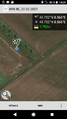 Santu Proof.PNG 405 × 720; 434 KB
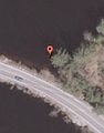 Satellite.jpg 285 × 364; 11 KB
 Schleswig-Holstein regional.svg 387 × 400; 514 KB
 Screenshot 2013-10-12-16-29-15.png 540 × 960; 61 KB
 Screenshot 2017-12-11-07-49-52.png 480 × 800; 186 KB
 Screenshot 2018-01-04-20-14-26.png 480 × 800; 165 KB
 Screenshot 2018-01-07-23-36-30.png 480 × 800; 193 KB
 Screenshot 2018-01-18-18-04-13.png 480 × 800; 592 KB
 Screenshot 2018-06-23-22-24-30.png 480 × 800; 646 KB
 Screenshot 2018-07-23-09-21-08.png 480 × 800; 178 KB
 Screenshot 2018-08-20-19-13-44.png 480 × 800; 249 KB
 Screenshot 2020-05-23-13-07-10.jpg 1,080 × 1,920; 585 KB
 Screenshot 2020-05-23-13-07-10.png 1,080 × 1,920; 622 KB
 Screenshot 20200620-185837.png 1,080 × 1,920; 171 KB
 Screenshot 20210117-135324 Geohash Droid.png 1,080 × 1,920; 1.82 MB
 Screenshot 20210417-230159.png 720 × 1,520; 469 KB
 Screenshot 24 4 2020.png 480 × 800; 1.1 MB
 SCz-landmap.png 1,080 × 466; 7 KB
 SCz-map.png 1,280 × 1,024; 361 KB
 Sehnde regional.svg 486 × 400; 8 KB
 Sermoa map 10.png 396 × 316; 101 KB
 Sermoa map 12.png 356 × 362; 121 KB
 Sermoa map 13.png 408 × 359; 135 KB
 Sermoa map 14.png 384 × 358; 125 KB
 Sermoa map 15.png 417 × 361; 164 KB
 Sermoa map 16.png 358 × 364; 140 KB
 Sermoa map 17.png 367 × 351; 145 KB
 Sermoa map 18.png 365 × 376; 147 KB
 Sermoa map 19.png 338 × 357; 134 KB
 Sermoa map 8.png 381 × 288; 89 KB
 Sermoa map 9.png 322 × 305; 84 KB
 Sermoa regions 4.png 216 × 290; 3 KB
 Smiley hashes.JPG 248 × 267; 29 KB
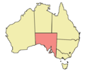 South Australia locator-MJC.PNG 563 × 476; 21 KB
 Star.JPG 640 × 515; 71 KB
 StarbirdRegioWisconsin.png 168 × 194; 3 KB
 StarbirdRegioWisconsin2.png 168 × 194; 2 KB
 StarbirdRegioWisconsin3.png 168 × 194; 1 KB
 Stuck1.JPG 617 × 425; 63 KB
 Stuck2.JPG 620 × 427; 78 KB
 SwensonjGeomap.png 500 × 500; 62 KB
 TagTheHashExample.png 979 × 610; 979 KB
 Telgte regional.svg 126 × 400; 20 KB
 TexasRegionalMap 4-17-14.png 280 × 290; 2 KB
 The county and graticule map 2013-08-08.jpg 1,596 × 1,185; 806 KB
 The county and graticule map 2013-08-10.jpg 1,596 × 1,185; 805 KB
 The county and graticule map 2013-12-29.jpg 1,596 × 1,185; 805 KB
 The county and graticule map 2014-02-03.jpg 1,596 × 1,185; 803 KB
 The county and graticule map 2014-06-14.jpg 1,596 × 1,185; 802 KB
 The county and graticule map 2014-06-15.jpg 1,596 × 1,185; 803 KB
 The county and graticule map 2014-06-16.jpg 1,596 × 1,185; 803 KB
 The county and graticule map 2014-06-27.jpg 1,596 × 1,185; 801 KB
 The county and graticule map 2018-11-25.jpg 1,596 × 1,185; 798 KB
 The county and graticule map 2018-12-15.jpg 1,596 × 1,185; 796 KB
 The county and graticule map 2019-02-03.jpg 1,596 × 1,185; 794 KB
 The county and graticule map 2019-03-24.jpg 1,596 × 1,185; 786 KB
 The county and graticule map 2019-05-13.jpg 1,596 × 1,185; 785 KB
 The county and graticule map 2019-06-13.jpg 1,596 × 1,185; 784 KB
 The county and graticule map 2019-06-28.jpg 1,596 × 1,185; 779 KB
 The county and graticule map 2019-08-03.jpg 1,596 × 1,185; 777 KB
 The county and graticule map 2022-03-06.jpg 1,596 × 1,185; 904 KB
 The county and graticule map 2022-04-06.jpg 1,596 × 1,185; 903 KB
 The county and graticule map 2022-06-12.jpg 1,596 × 1,185; 902 KB
 The county and graticule map 2023-05-02.jpg 1,596 × 1,185; 877 KB
 The county and graticule map 2023-12-20.jpg 1,596 × 1,185; 856 KB
 Thetwomelbournegraticles.gif 539 × 326; 96 KB
 Tongs-hashes.png 714 × 1,037; 708 KB
 Torodeas ERH.svg 518 × 400; 170 KB
 Screenshot from 2023-07-12 11-26-38.png 737 × 472; 392 KB
 Screenshot from 2023-07-12 11-28-41.png 739 × 472; 232 KB
 Track110222 51 11.png 719 × 560; 159 KB
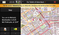 TToA.png 800 × 480; 270 KB
 User Greenslime Hashes 2010-10-13.JPG 728 × 520; 59 KB
 User Greenslime Hashes 2010-11-04.JPG 1,028 × 556; 88 KB
 Quarters of Vahrenwald-List.png 701 × 388; 52 KB


