2009-01-17 52 7
| Sat 17 Jan 2009 in 52,7: 52.3238594, 7.1391970 geohashing.info google osm bing/os kml crox |
Plan
Arvid noticed this was in an area he didn't hash before. Just north of Bad Bentheim, in the woods. A very nice area.
The weather was hot, at 6°C. It was cloudy. And rainy. And cloudy. And windy. Anyway, I needed to get out and start training again! I expected the last bits of road to be unpaved, and had no idea if they would be publicly accessable.
Achievements
- Arvid cycled 62.5km
- A nice new collection of [No Trespassing|No Trespassing] signs.
Expedition
Arvid's tracklog by bicycle.
Later & upcoming.
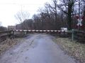
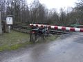
Railwaycrossing where you
call to get passed.
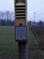
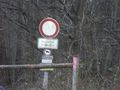
No trespassing.
Not very attractive to trespass anyway.

Sad geohasher.
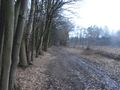
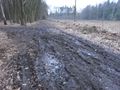
Muddy road.
Ha, my bike will go under there no problem!
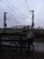
Oh. A train. A dutch locomotive in Germany.
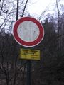
More no trespassing
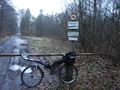
Bike and more no trespassing.
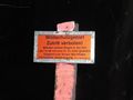
Tranzlate plz?
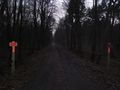
There are 2 of them.
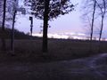
And there was a bit of sunlight on the way back.


