File:2009-05-17 48 -123 lowElevation.jpg
From Geohashing
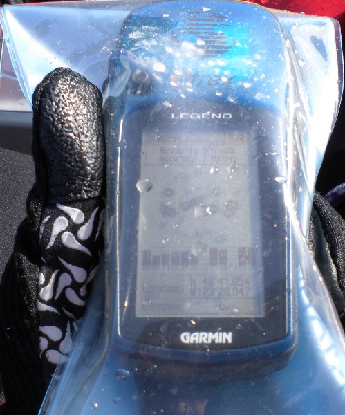
Revision as of 21:58, 18 May 2009 by imported>Elbie (The area that 2009-05-17 48 -123 was at had an elevation of -6 metres. (My shots of the GPS at the exact coordinate are rather blurry.) Category:Meetup in 48 -123 Category:Meetup on 2009-05-18)
No higher resolution available.
2009-05-17_48_-123_lowElevation.jpg (499 × 600 pixels, file size: 65 KB, MIME type: image/jpeg)
The area that 2009-05-17 48 -123 was at had an elevation of -6 metres. (My shots of the GPS at the exact coordinate are rather blurry.)
File history
Click on a date/time to view the file as it appeared at that time.
| Date/Time | Thumbnail | Dimensions | User | Comment | |
|---|---|---|---|---|---|
| current | 17:29, 30 January 2020 | | 499 × 600 (65 KB) | Maintenance script (talk | contribs) |
- You cannot overwrite this file.
File usage
The following 2 pages link to this file: