Mansfield, Ohio
From Geohashing
Revision as of 14:37, 25 May 2008 by imported>Tytrain (created gallery and placeholder caption. Or final one. I like it.)
| Toledo, Ohio | Sandusky, Ohio | Cleveland, Ohio |
| – | Mansfield, Ohio | Canton, OH |
| – | – | – |
[[Category:Meetup in {{{lat}}} {{{lon}}}| ]]
Today's Location: [Mansfield (40,-82)]
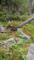
The Mansfield graticule is at (40, -82). The graticule is almost completely rural, created high odds the geohash will be in a nice field somewhere. Also contained are such scenic areas as the Mohican and Alum Creek state parks. Major cities include the northeast portion of Columbus, Ohio (which is split almost exactly at its center into four graticules), Mansfield, Ashland, Bucyrus, and Mt. Vernon.
Activities
First Saturday meetup. Anyone want to go?
Ernest will be at the Monday 5/26 geohash (with friends!). Who's with him?
Notable Events
Rattail, Sandy, and Butters made the first documented geohash in this graticule on May 23, 2008.
- Pictures
Local Geohashers
- Ernest might hit up a few, but is mostly bummed he missed out on one earlier this week three minutes from his house.
