2009-12-31 29 -90
| Thu 31 Dec 2009 in 29,-90: 29.6980729, -90.6080772 geohashing.info google osm bing/os kml crox |
Location
It's on the outskirts of Houma; about an hour drive from me. Actual destination is a mere 1109.7 feet (338.2 meters) from the road.
Looks to be right on the line between two peoples' property. Hopefully they don't think I'm shrooming like most people found randomly wandering a field on private property in Louisiana would be.
Participants
Plans
There aren't many. Going to drive down there, take pictures, and come back. It's my first geohash. I don't have a GPS, just going to wing it since on Google Maps it appears to be the northmost tree in a particular line of trees. Couldn't convince anyone to come with but I dig doing things solo anyway.
Expedition
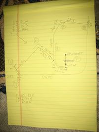
Well, getting on to I-10W then I-310S then US-90W was simple, but still a lot of fun. I went over a cable-stayed bridge that I forgot was there. I passed a 29.860709,-90.451385 refinery once on US90--knew I was going to enter refinery territory but wasn't sure when. This whole graticule is mostly refinery territory... or swamp.
Anyway, once I got about 90% there I was mostly surrounded by swamps that had been poorly converted to farmland. LA-182 intersects US-90 in at least three places, not knowing this I took the first one, ended up making friends with some deer in the middle of some field of some crops.
Once I figured out what was going on, I continued to the point where I get off the highway for reals. Well, I was supposed to get off on LA182 then turn onto Willow, or so I thought. Actually, I get off of LA182 and THE ROAD turns into Willow. I went back and forth down Willow five or six times, turning down various streets trying to figure out if they were Willow. So, unable to find Willow, which I was on, I stopped at a truck stop and called my friend Ajit. He told me that I hadn't gone far enough and that Willow was about a mile further. I ended up in a less-than-desirable neighboorhood for me to be in, and wandered around in it for a few minutes before somehow being spit out onto a non-neighborhood road. I called Ajit again, and together we realized that I had somehow ended up on the road that the hashpoint was on!
So, I drove by two or three places that looked like the satellite images. I called Ajit again to ask him questions like "is there water on the other side of the road?" etc etc etc etc etc. I finally found it! At the time, I was about 65% sure, but I looked it up once I got home and it turns out I was right.
This is where it gets... fun. Firstly, I parked on a shoulder right next to a "Do Not Park On Shoulder" sign. Next, while walking from my fetch to the point, approximately every dog in Raceville was somehow alerted to my presence and they all started barking.
Then I electrocuted myself on a cattle enclosure. Oops.
I attempted to walk around the fence, but ran into annoying swamp that someone was calling a field. I wasn't in the mood, as I wasn't even sure I was trespassing on the correct person's property, not to mention it was already dark, and so I gave up. It turns out I was about 784 feet from the hashpoint, having walked 230 of the 1100 I was supposed to walk. Oops.
