2008-05-24 38 -87
From Geohashing
Revision as of 23:23, 24 May 2008 by imported>Quicksilver (New page: {{meetup graticule | map=<map lat="38" lon="-87" date="2008-05-24" /> | lat=38 | lon=-87 | date=2008-05-24 }} The Vincennes geohash for Saturday was located in a wheat field off of Baseli...)
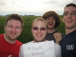
| Sat 24 May 2008 in 38,-87: 38.1266480, -87.5475331 geohashing.info google osm bing/os kml crox |
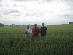
The Vincennes geohash for Saturday was located in a wheat field off of Baseline Road and Highway 41. Some adventuring was required to reach the field, over drainage ditches and poison ivy encrusted embankments.
People
Quicksilver, Caleb, Zach, and Brandon reached the geohash around 4:15pm, but there was no sign of other geohashers, past or present.
- Click for larger photo.