2012-10-17 54 -2
From Geohashing
Revision as of 14:12, 17 October 2012 by imported>Angel (As on Sunday, I think I'll have to submit "No access" - farmer appears to have blocked off public footpath, and I hear dog(s) in the yard [http://www.openstreetmap.org/?lat=54.11420000&lon=-2.63239000&zoom=16&layers=B000FTF @54.1142,-2.6324])
| Wed 17 Oct 2012 in 54,-2: 54.0912733, -2.5897449 geohashing.info google osm bing/os kml crox |
Location
Between Halton and Wray, 9 miles from the centre of Lancaster.
Participants
Plans
Google Maps says this should be accessible on foot, 12 miles from home. I planned to set off early, but I only managed to get up at 10. Still, now (at the time of posting) its nearly noon, and I've already covered nearly 5 miles and am coming up to the Crook o'Lune picnic site, which is probably around 5 miles from the hashpoint. I'm sure I can make it in time, heading up the Lune cyclepath (National Cycle Route 69) as far as Bull Beck then turning onto the road.
Expedition
Tracklog
Photos
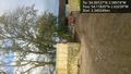
As on Sunday, I think I'll have to submit "No access" - farmer appears to have blocked off public footpath, and I hear dog(s) in the yard @54.1142,-2.6324

Achievements