2013-03-24 38 -76
From Geohashing
Revision as of 17:33, 24 March 2013 by imported>OfficeLinebacker (The actual location was right on the fence line. Success! [http://www.openstreetmap.org/?lat=38.80084923&lon=-77.00392210&zoom=16&layers=B000FTF @38.8008,-77.0039])
| Sun 24 Mar 2013 in 38,-76: 38.9251623, -76.6613839 geohashing.info google osm bing/os kml crox |
Location
Near what appears to be a training horse racing track in Davidsonville, MD
Participants
- OfficeLinebacker (talk)
- Allison
Plans
The plan is to leave from Rockville/Kensington, and go to this one, then circle around the bottom arc of the DC Beltway to the one for DC West, which is in Haymarket, VA: http://wiki.xkcd.com/geohashing/2013-03-24_38_-77
Expedition
Tracklog
Photos

Silly grins @38.8064,-76.9896
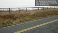
The actual location was right on the fence line. Success! @38.8008,-77.0039


Achievements