File:Geohash -35 142 2013-09-18 GPS.JPG
From Geohashing
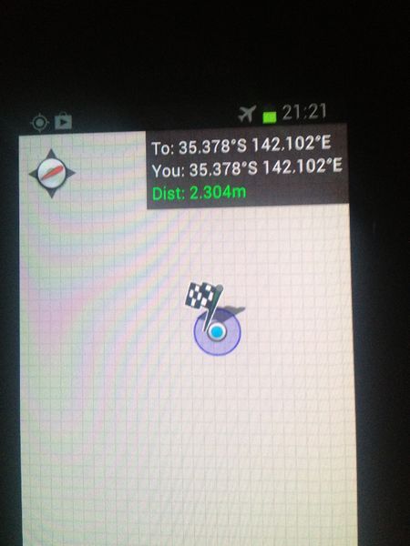
Revision as of 00:10, 21 September 2013 by imported>Felix Dance (Phone GPS proof at the 2013-09-18 -35 142 geohash undertaken by Felix Dance and Tom in a wheat field 11 kms west of Patchewollock. Category: Meetup on 2013-09-18 Category: Meetup in -35 142)

Size of this preview: 450 × 600 pixels. Other resolutions: 180 × 240 pixels | 1,224 × 1,632 pixels.
Original file (1,224 × 1,632 pixels, file size: 776 KB, MIME type: image/jpeg)
Phone GPS proof at the 2013-09-18 -35 142 geohash undertaken by Felix Dance and Tom in a wheat field 11 kms west of Patchewollock.
File history
Click on a date/time to view the file as it appeared at that time.
| Date/Time | Thumbnail | Dimensions | User | Comment | |
|---|---|---|---|---|---|
| current | 16:04, 30 January 2020 | | 1,224 × 1,632 (776 KB) | Maintenance script (talk | contribs) |
- You cannot overwrite this file.
File usage
The following page links to this file: