2016-07-19 62 26
| Tue 19 Jul 2016 in 62,26: 62.3051341, 26.7136473 geohashing.info google osm bing/os kml crox |
Location
In Pohjoisniitty, Venetmäki, Pieksämäki, Finland. The point lies in a forest.
Participants
- Tilley
- Mrs. Tilley
Expedition
Almost forgot to write this report! How is it possible? Well, I had been having a busy summer vacation, roaming around here and there, most recently in Keuruu. Mrs. Tilley had some work to do in Joensuu, and the necessary logistics required me to take her there and come back with our other car (to be able to later transport our freezer with the berries picked during the vacation to our home). Our daughter stayed with grandma and grandpa for this round trip, so with only adult passengers it was a good opportunity to score a couple of hashpoints in the way. And the hashpoints lined up very well along the route! The first one meant only 10 km detour and the other one less than 5 km.
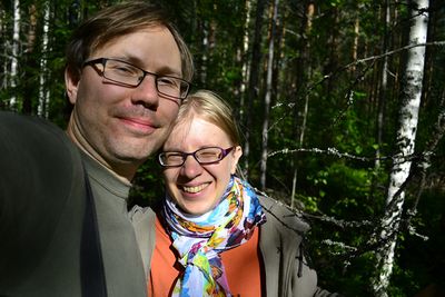
The first one was in the stretch between Hankasalmi and Pieksämäki. With hand-written notes and pre-researched google streetview pictures the right route was easily found. The point was only 10 metres into the forest from a logging road turning circle. There was a bit of a thicket, but with the right approach we didn't have to change our outfit from the shorts and sandals -style. Quickly the point was reached. Satellite reception was quite poor, about 4 meters was the best I could achieve, although the weather was beautiful and sunny. Maybe the space weather was different somehow. Mosquitoes approaching us, we took some pictures and retreated to the car.
And continued to the next point.
Photos
Achievements
Tilley&co earned the Land geohash achievement
|


