File:2018-07-31 42-3 map.png
From Geohashing
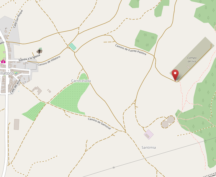
Revision as of 21:52, 31 July 2018 by imported>Gormaz (One of the maps I printed for the expedition. It shows the two rounded buildings and the old shooting range. Category: Meetup on 2018-07-31 Category: Meetup in 42 -3)

Size of this preview: 732 × 600 pixels. Other resolutions: 293 × 240 pixels | 742 × 608 pixels.
Original file (742 × 608 pixels, file size: 129 KB, MIME type: image/png)
One of the maps I printed for the expedition. It shows the two rounded buildings and the old shooting range.
File history
Click on a date/time to view the file as it appeared at that time.
| Date/Time | Thumbnail | Dimensions | User | Comment | |
|---|---|---|---|---|---|
| current | 13:59, 30 January 2020 | | 742 × 608 (129 KB) | Maintenance script (talk | contribs) |
- You cannot overwrite this file.
File usage
The following page links to this file: