2018-12-23 44 -89
From Geohashing
Revision as of 02:48, 24 December 2018 by imported>WausauBill (→Participants)
| Sun 22 Jul 2012 in 55,-17: 55.5994754, -17.7209116 geohashing.info google osm bing/os kml crox |
Location
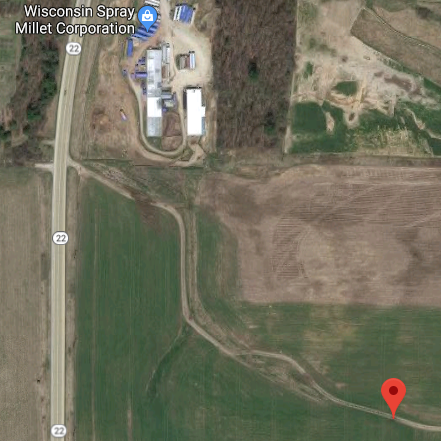
As might be expected in Wisconsin, the hash was in a farm field, this one just outside of Wild Rose, WI. The SO and I were returning from a visit to her sister when I saw that a "slight" detour from our route would put on the state highway next to the hash. The satellite picture shows it next to a business, one that I figured would be closed on Christmas Eve eve.
We had hoped maybe that what looks like a road on the satellite would turn out to be one, but it was only a track. The walk from where the track goes to the road (at the top of the picture) to the hash was about a 1/4 mile, for scale.
Participants
WausauBill (talk) and the love of my life, Kathy V.
Plans
Expedition
Tracklog
Photos
Achievements
