2018-12-23 44 -89
From Geohashing
Revision as of 02:49, 24 December 2018 by imported>WausauBill (→Plans)
| Sun 22 Jul 2012 in 55,-17: 55.5994754, -17.7209116 geohashing.info google osm bing/os kml crox |
Location
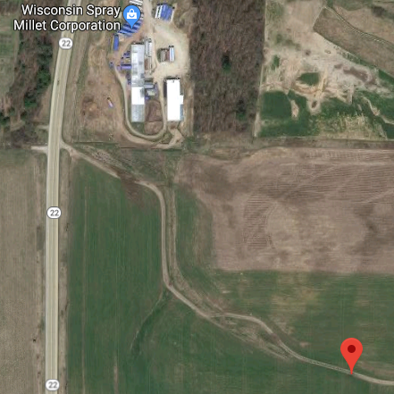
As might be expected in Wisconsin, the hash was in a farm field, this one just outside of Wild Rose, WI. The SO and I were returning from a visit to her sister when I saw that a "slight" detour from our route would put on the state highway next to the hash. The satellite picture shows it next to a business, one that I figured would be closed on Christmas Eve eve.
We had hoped maybe that what looks like a road on the satellite would turn out to be one, but it was only a track. The walk from where the track goes to the road (at the top of the picture) to the hash was about a 1/4 mile, for scale.
Participants
WausauBill (talk) and the love of my life, Kathy V.
Plans
Looked pretty simple, pull off the road onto the track, walk back to the hash.
Expedition
Tracklog
Photos
Achievements
