2008-06-18 1 103
| Wed 18 Jun 2008 in 1,103: 1.3634880, 103.7512723 geohashing.info google osm bing/os kml crox |
About
1.363488035554146, 103.75127233865797
According to Google Maps, this one's at Block 338 Bukit Batok Street 34. For a map which marks block numbers and gives more landmarks, use SLA's StreetMap@Singapore (search the block number and street name).
Expeditions
r0d3n7z
Had work, so went after dinner. (Alas, my camera phone doesn't do very well at night; the pictures are quite awful so I had to select the better ones and enhance them. Also reduced the resolution, picture quality wasn't worth it.)
As usual, I travelled by public transport (to Bukit Gombak MRT station) [1.3589,103.7518] and then walked. I reached the junction [1.3637,103.7515] of Bukit Batok West Ave 5 and Bukit Batok Street 34 at 21:45. Photo of the junction also shows the apartment block at the geohash location (sign is blurry, though).
I also took a short detour over to Swiss Cottage Secondary School, which is just across the road, directly north of block 338. Photo of the school gate -- sign is blurry, and English text (bottom row) is obscured by the hedge, but the top row (Malay) is somewhat more visible: "Sekolah Menengah Swiss Cottage".
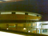
The exact location of the geohash is about halfway down the shorter leg of the L-shaped building; in the middle of this photo.
I must have looked rather suspicious loitering around and snapping pictures at such a late hour, so I left after about 15 minutes. Rewarded myself with waffles, took the train home.
As a side note, someone (with a NUS IP address) was deterred by heavy rain earlier in the day. Too bad we couldn't arrange to meet up for this one.
- Pictures
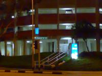
Junction of Bukit Batok West Ave 5 and Bukit Batok Street 34, with Block 338 behind.
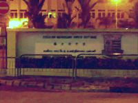
Swiss Cottage Secondary School.
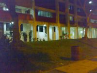
The exact spot is around the middle of this photo.
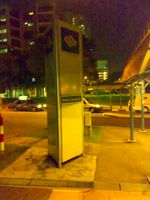
Public transport FTW. (South entrance, Bukit Gombak MRT station.)
Bukit Gombak Sports Hall is another landmark in the area [1.3598,103.7523].


