2020-04-12 39 -77
From Geohashing
Revision as of 17:08, 12 April 2020 by OfficeLinebacker (talk | contribs) ([live picture]This is a tributary of Rock Creek which I will walk parallel to so that I only have to cross one Creek. [https://openstreetmap.org/?lat=39.10783440&lon=-77.12784810&zoom=16&layers=B000FTF @39.1078,-77.1278])
| Sun 12 Apr 2020 in 39,-77: 39.1107284, -77.1226240 geohashing.info google osm bing/os kml crox |
Location
Participants
Plans
Expedition
- Definitely going for this one today. It's actually very close to where I hiked regularly. -- OfficeLinebacker (talk) 12:15, 12 April 2020 (EDT)
Tracklog
Photos
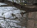
Warning signs? @39.1078,-77.1305
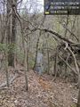
This is a tributary of Rock Creek which I will walk parallel to so that I only have to cross one Creek. @39.1078,-77.1278


Achievements