File:2020-07-11 32 -116 scerruti 1594396584494.jpg
From Geohashing
Revision as of 15:56, 10 July 2020 by Scerruti (talk | contribs) (Tacate is an inactive graticule. I am an inactive geohasher. Could that change on 7/11? This expedition is in the Cleveland National Forest about 1/10th of a mile from the Sunset Trail and about 1/3 of a mile from the trailhead at Sunrise Highway. Pa...)
2020-07-11_32_-116_scerruti_1594396584494.jpg (628 × 600 pixels, file size: 130 KB, MIME type: image/jpeg)
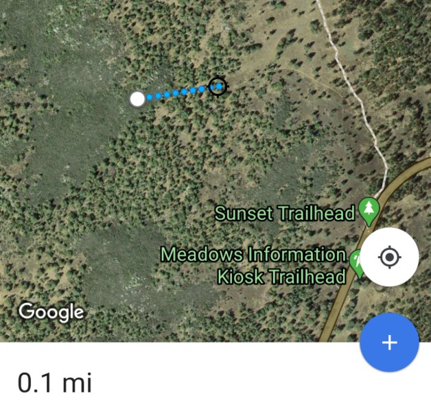
Tacate is an inactive graticule. I am an inactive geohasher. Could that change on 7/11?
This expedition is in the Cleveland National Forest about 1/10th of a mile from the Sunset Trail and about 1/3 of a mile from the trailhead at Sunrise Highway. Parking and portable bathrooms are available on site but no water.
If you are interested please contact me so we can plan a socially distant meetup.
File history
Click on a date/time to view the file as it appeared at that time.
| Date/Time | Thumbnail | Dimensions | User | Comment | |
|---|---|---|---|---|---|
| current | 15:56, 10 July 2020 |  | 628 × 600 (130 KB) | Scerruti (talk | contribs) | Tacate is an inactive graticule. I am an inactive geohasher. Could that change on 7/11? This expedition is in the Cleveland National Forest about 1/10th of a mile from the Sunset Trail and about 1/3 of a mile from the trailhead at Sunrise Highway. Pa... |
- You cannot overwrite this file.
File usage
The following page links to this file:
