2021-11-10 55 37
From Geohashing
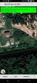
| Wed 10 Nov 2021 in 55,37: 55.5157004, 37.3911342 geohashing.info google osm bing/os kml crox |
Location
Participants
Plans
Expedition
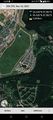
Tracklog
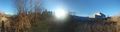
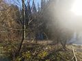
Photos
Coordinates reached
On the bank of Desna river just outside of "Anderssen" neighbourhood of New Moscow.
At the hash @55.5157,37.3911
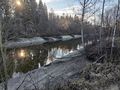
Desna river near the hash @55.5157,37.3912
Desna river near the hash @55.5238,37.3968


Achievements