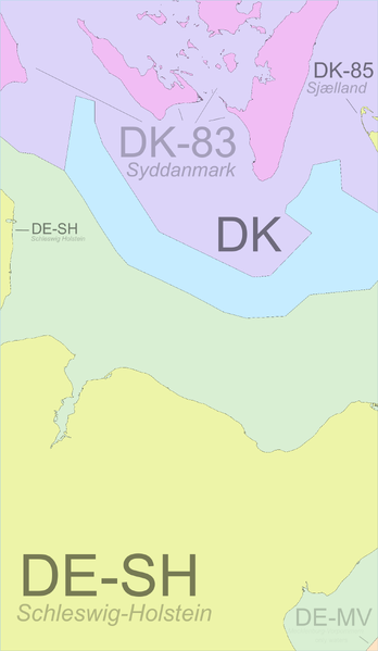
File:Region 54,10 Admin 4.svg
From Geohashing
Revision as of 04:59, 24 April 2023 by Leidenfrost (talk | contribs) (Leidenfrost uploaded a new version of File:Region 54,10 Admin 4.svg)

Size of this PNG preview of this SVG file: 348 × 599 pixels. Other resolution: 139 × 240 pixels.
Original file (SVG file, nominally 1,614 × 2,778 pixels, file size: 243 KB)
Summary
It seems to be the case that the subdivisions of Denmark do not lay claim to any specific waters; Denmark as a whole claims the waters.
Colouring based on: this (Europe); this (Germany); and this (Denmark) file
File history
Click on a date/time to view the file as it appeared at that time.
| Date/Time | Thumbnail | Dimensions | User | Comment | |
|---|---|---|---|---|---|
| current | 04:59, 24 April 2023 |  | 1,614 × 2,778 (243 KB) | Leidenfrost (talk | contribs) | smaller dimensions |
| 04:58, 24 April 2023 | Error creating thumbnail: convert: unable to extend cache '/tmp/magick-T4ItPdGPCXWCgxFBPZskUdpC3VaFtD4V': File too large @ error/cache.c/OpenPixelCache/3901.
convert: no images defined `PNG:/tmp/transform_348e7a7aa701.png' @ error/convert.c/ConvertImageCommand/3325.
| 2,320 × 3,996 (243 KB) | Leidenfrost (talk | contribs) | == Summary == It seems to be the case that the subdivisions of Denmark do not lay claim to any specific waters; Denmark as a whole claims the waters. Colouring based on: [https://commons.wikimedia.org/wiki/File:Europe,_administrative_divisions_-_ISO31... |
- You cannot overwrite this file.
File usage
The following page links to this file: