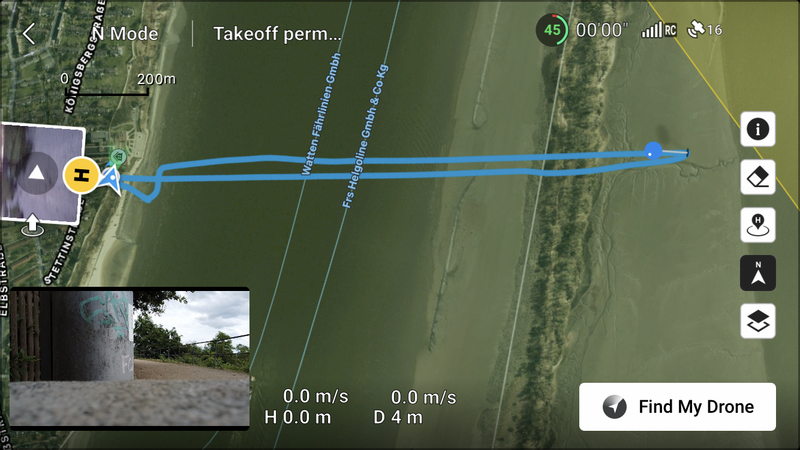
File:1998-01-04 53 9 - Screenshot drone path.png
From Geohashing

Size of this preview: 800 × 450 pixels. Other resolutions: 320 × 180 pixels | 1,334 × 750 pixels.
Original file (1,334 × 750 pixels, file size: 3.43 MB, MIME type: image/png)
Screenshot of the drone's path for 1998-01-04 53 9.
File history
Click on a date/time to view the file as it appeared at that time.
| Date/Time | Thumbnail | Dimensions | User | Comment | |
|---|---|---|---|---|---|
| current | 21:37, 5 July 2023 | | 1,334 × 750 (3.43 MB) | Rsge (talk | contribs) |
- You cannot overwrite this file.
File usage
The following page links to this file: