Difference between revisions of "1952-04-14 59 18"
From Geohashing
imported>Jiml m (Add retro flag) |
imported>Cjk ([retro picture]) |
||
| Line 39: | Line 39: | ||
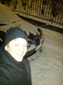
Image:1952-04-14_59_18_18-53-53-267.jpg | GPS confused [http://www.openstreetmap.org/?lat=59.33460000&lon=18.03820000&zoom=16&layers=B000FTF @59.3346,18.0382] | Image:1952-04-14_59_18_18-53-53-267.jpg | GPS confused [http://www.openstreetmap.org/?lat=59.33460000&lon=18.03820000&zoom=16&layers=B000FTF @59.3346,18.0382] | ||
| + | |||
| + | Image:1952-04-14_59_18_18-16-37-138.jpg | | ||
</gallery> | </gallery> | ||
Revision as of 17:16, 9 February 2012
| Mon 14 Apr 1952 in 59,18: 59.3343714, 18.0381656 geohashing.info google osm bing/os kml crox |
Location
Participants
Plans
Expedition
Tracklog
Photos

GPS confused @59.3346,18.0382


Achievements