Difference between revisions of "2008-05-24 29 -95"
From Geohashing
imported>Photosinensis |
imported>Photosinensis |
||
| Line 20: | Line 20: | ||
* [http://maps.google.com/maps?f=q&hl=en&geocode=&q=29.126648%C2%B0,+-95.547534%C2%B0&ie=UTF8&t=h&z=16&iwloc=addr google maps] | * [http://maps.google.com/maps?f=q&hl=en&geocode=&q=29.126648%C2%B0,+-95.547534%C2%B0&ie=UTF8&t=h&z=16&iwloc=addr google maps] | ||
| − | [[Category:Houston Graticule]] | + | [[Category:Houston Graticule| Meetings: 2008-05-24 29 -95]] |
Revision as of 02:56, 25 May 2008
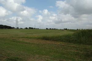
The Houston location is on Bunkhouse Trail, just south of Lake Bluebonnet, in the Bar X Ranch subdivision, a few miles west of Angelton.


