Difference between revisions of "2008-05-24 38 -121"
imported>Polysylabic Pseudonym (Categorising.) |
m |
||
| (5 intermediate revisions by 4 users not shown) | |||
| Line 13: | Line 13: | ||
</gallery> | </gallery> | ||
| − | First picture posted by user Demon Eye. | + | First picture posted by user [[User:Demon Eye|Demon Eye]]. |
| − | A separate | + | A separate was at the same sign earlier in the day. We arrived at about 4:30 local time, and actually encountered the farmer driving away from the location. We asked him innocently if we were on his property and he told us that we were. He asked if we were sightseeing and we decided that was a good alibi and agreed. He said that we could continue down to the "tower with the tank on the top" to turn around, where no trespassing sign was (the tower with tank is off to the right of the sign in the picture). |
Disappointed that we could not ethically reach the true destination, we instead braved some unpaved levee roads and visited the [http://en.wikipedia.org/wiki/KXTV/KOVR_Tower KXTV television tower] north of the meet-up point which happens to be the tallest structure in California and one of the tallest structures ever to exist. | Disappointed that we could not ethically reach the true destination, we instead braved some unpaved levee roads and visited the [http://en.wikipedia.org/wiki/KXTV/KOVR_Tower KXTV television tower] north of the meet-up point which happens to be the tallest structure in California and one of the tallest structures ever to exist. | ||
| Line 26: | Line 26: | ||
Image:NoahRejectsKXTVTower.jpg | Image:NoahRejectsKXTVTower.jpg | ||
</gallery> | </gallery> | ||
| + | |||
| + | [[Category:Expeditions]] | ||
[[Category:Expeditions with photos]] | [[Category:Expeditions with photos]] | ||
| − | [[Category: | + | [[Category:Coordinates not reached]] |
| + | [[Category:Not reached - No public access]] | ||
| + | {{location|US|CA|SJ}} | ||
Latest revision as of 23:24, 18 March 2022
| Sat 24 May 2008 in 38,-121: 38.1266480, -121.5475331 geohashing.info google osm bing/os kml crox |
- The closest point reached.
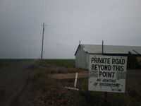
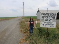


First picture posted by user Demon Eye.
A separate was at the same sign earlier in the day. We arrived at about 4:30 local time, and actually encountered the farmer driving away from the location. We asked him innocently if we were on his property and he told us that we were. He asked if we were sightseeing and we decided that was a good alibi and agreed. He said that we could continue down to the "tower with the tank on the top" to turn around, where no trespassing sign was (the tower with tank is off to the right of the sign in the picture).
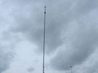
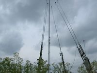
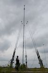
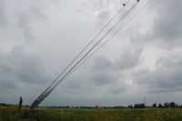
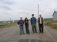
Disappointed that we could not ethically reach the true destination, we instead braved some unpaved levee roads and visited the KXTV television tower north of the meet-up point which happens to be the tallest structure in California and one of the tallest structures ever to exist.
- The KXTV TV broadcast tower.