Difference between revisions of "2008-06-07 31 -97"
From Geohashing
imported>Elenaran (→About) |
imported>Elenaran (→The Meetup) |
||
| Line 10: | Line 10: | ||
<gallery caption="Photo Gallery" widths="200px" heights="200px" perrow="3"> | <gallery caption="Photo Gallery" widths="200px" heights="200px" perrow="3"> | ||
| − | Image:2008-06-07_31_-97_gps.jpg | + | Image:2008-06-07_31_-97_gps.jpg|Blurry shot of the GPS at the geohash location. |
| − | Image:2008-06-07 31 -97 north.jpg | + | Image:2008-06-07 31 -97 north.jpg|Looking (roughly) North from the location. |
| − | Image:2008-06-07 31 -97 east.jpg | + | Image:2008-06-07 31 -97 east.jpg|Looking (roughly) East from the location. |
</gallery> | </gallery> | ||
Revision as of 22:39, 10 June 2008
About
This hash was located East of Loop 340 in Waco, TX. GPS: (33.501784N, 97.114371W)
Weather was warm with lots of sun.
The Meetup
User GreyGndalf and myself (elenaran) hiked out 100 yards into the middle of a corn field on the outskirts of Waco, TX. Walking against the grain of a corn field is not as easy as one might think! We looked around for quite some time for other geohashers in the corn field with no luck. They must have been hiding.
- Photo Gallery
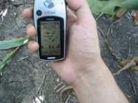
Blurry shot of the GPS at the geohash location.
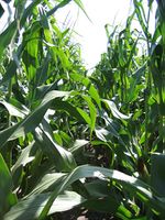
Looking (roughly) North from the location.
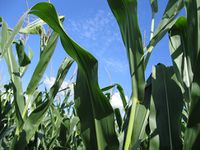
Looking (roughly) East from the location.


