Difference between revisions of "2008-06-11 -43 172"
From Geohashing
imported>Evil Monkey (New page: {{meetup graticule | map=<map lat="-43" lon="172" date="2008-06-11" /> | lat=-43 | lon=172 | date=2008-06-11 | graticule_name=Christchurch, New Zealand | graticule_link=Christchurch, New Z...) |
imported>FippeBot m (Location) |
||
| (2 intermediate revisions by 2 users not shown) | |||
| Line 14: | Line 14: | ||
Got out to the stretch of road I wanted but in the process of trying to remember where the hash was from memory, got myself disorientated and was looking on the north side of the road and not the south side of the road. In the end I was about 200 metres from the hash. | Got out to the stretch of road I wanted but in the process of trying to remember where the hash was from memory, got myself disorientated and was looking on the north side of the road and not the south side of the road. In the end I was about 200 metres from the hash. | ||
| − | <gallery> | + | <gallery perrow="3"> |
Image:2008-06-11 -43 172 1.jpg|The field on the left is probably where the geohash was | Image:2008-06-11 -43 172 1.jpg|The field on the left is probably where the geohash was | ||
Image:2008-06-11 -43 172 3.jpg|The stop sign you were warned of in the previous photograph. | Image:2008-06-11 -43 172 3.jpg|The stop sign you were warned of in the previous photograph. | ||
| Line 20: | Line 20: | ||
Image:2008-06-11 -43 172 4.jpg|Me! | Image:2008-06-11 -43 172 4.jpg|Me! | ||
</gallery> | </gallery> | ||
| + | |||
| + | [[Category:Expeditions]] | ||
| + | [[Category:Expeditions with photos]] | ||
| + | [[Category:Coordinates not reached]] | ||
| + | [[Category:Not reached - Technology]] | ||
| + | [[Category:Expedition without GPS]] | ||
| + | {{location|NZ|CAN}} | ||
Latest revision as of 04:58, 7 August 2019
| Wed 11 Jun 2008 in Christchurch, New Zealand: -43.5535325, 172.3987999 geohashing.info google osm bing/os kml crox |
Evil Monkey
On seeing that this geohash was relatively close to town, I hopped on my bike and made my way out there. Had two slight problems:
- I don't have a GPS.
- Did create Google Map directions for getting there, but forgot to get the print out of the map showing the exact location in the field it was in.
Got out to the stretch of road I wanted but in the process of trying to remember where the hash was from memory, got myself disorientated and was looking on the north side of the road and not the south side of the road. In the end I was about 200 metres from the hash.
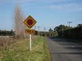
The field on the left is probably where the geohash was
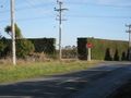
The stop sign you were warned of in the previous photograph.
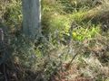
Some gorse

Me!


