Difference between revisions of "2008-06-22 39 -84"
From Geohashing
imported>M5rammy |
imported>M5rammy (→Gallery) |
||
| Line 37: | Line 37: | ||
== Gallery == | == Gallery == | ||
| − | + | <gallery caption="Pictures" widths="200px" heights="200px" perrow="2"> | |
| − | + | Image:m5r_06_22_08a.jpg | The location, in general | |
| − | + | Image:m5r_06_22_08b.jpg | nearly there | |
| − | + | Image:m5r_06_22_08c.jpg | Facing East | |
| − | + | Image:m5r_06_22_08d.jpg | Facing West | |
| − | + | </gallery> | |
Revision as of 00:12, 23 June 2008
| Sun 22 Jun 2008 in 39,-84: 39.7465293, -84.2642328 geohashing.info google osm bing/os kml crox |
| Prev Sat SMTWTF Next Sat |
Neighboring Meetups today → |
NW | N | NE |
| W | us | E | ||
| SW | S | SE |
Contents
About
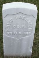
This meetup was at the National Cemetery of the VAMC on 4100 W Third St.
People
- m5rammy - I brought some games and some books to swap (but not exactly by the graves, obviously).
No one else showed up :-(
Comments
It was a pleasant calm day, very peaceful.
But I found my Tomtom is not very accurate for pinpointing locations. Walking with it, it seems to be keeping track, then I stop, and the numbers keep changing a short while. Walking again, slowly, the numbers don't change, then suddenly they jump by up to 5 (0.00005°). I know it is not a big difference, but I wanted to be where it would show the exact numbers given by the hash.
Good thing I had looked carefully at Google maps and counted how many rows and how many gravestones to go.
Gallery
- Pictures

The location, in general

nearly there
Facing East

Facing West


