2008-08-09 45 -76
| Sat 9 Aug 2008 in Renfrew: 45.0913829, -76.0585948 geohashing.info google osm bing/os kml crox |
Expedition by Wojciech Kozlowski
I live near the west side of the Ottawa graticule, so I thought I'd try to reach today's Renfrew graticule point instead. According to Google Maps, the point was in a forest a bit south of Carleton Place. So, armed with my trusty GPS, and some water and food to snack on, I figured I would be in for a challenging, but manageable, hike though the forest. So I thought, anyway.
Well, it appears that due to all the rain we had lately, my destination was less a forest and more a swamp. This was definitely something I had not planned for. I managed to make some headway into the forest by jumping between fallen logs, moss and patches of dry of land, but the swamp eventually became impassable.
Logopolis earned the My kingdom for a boat consolation prize
|
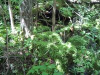
Gallery
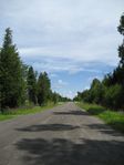
The road to the geohash.
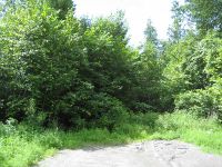
End of the road. It's on foot from here!
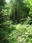
Edge of the forest. So far, so good...
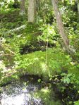
The unexpected swamp.
...And more swamp.


