Difference between revisions of "2008-09-20 52 5"
imported>Arvid (+ loads images.) |
imported>Arvid (story, photocomments. gpstrack doesnt work yet though, but will in an hour or maybe 2.) |
||
| Line 11: | Line 11: | ||
==Achievements== | ==Achievements== | ||
| − | * | + | *[[MNB_Geohash|Mother Nature's Bitch]], and still doubting if [[My Kingdom for a Boat|a boat]] would've helped, or that it was inaccessible anyway because there would be a lot of reed, making it more a [[There Might be Alligators!]] |
| − | *Cycled 236.9km. | + | *[[Bicycle Geohash|Cycled]] 236.9km. |
| − | *Drag along | + | *[[Drag-Along_Geohash|Dragged along]] another recumbent rider. |
==Expedition== | ==Expedition== | ||
| − | + | [http://maps.google.com/maps?f=q&hl=en&geocode=&q=http:%2F%2Farvid.org%2Ftracks%2Fgeohash20080920.kmz Tracklog] | |
| + | |||
| + | Around 9:30 Arvid and the fellow recumbent rider(riding an [http://www.velomobiling.com/gallery/Velomobile1/Velomobiles/FAW/ Alleweder]) met at the main university campus entrance. They weren't going to take the easy route to Kampen, oh no. They would conquer every possible hill(all three of them!, one with 10%) that could reasonably fit in the route. Making the route about 15-20km longer than necessary. | ||
| + | Along the way they found there was a rally going on just next to the main road they followed. | ||
| + | |||
| + | Around xxxx they reached the point on the road closest to the hash, which was a dead end with a birdviewerstower. Arvid kind of expected a place like that, although it doesnt exist on google maps. It has a view over the unused land on the outside of the dyke and over the Ketelmeer(kettle-lake). | ||
| + | |||
| + | It also gave them a view in the direction of the hashpoint. Neither of the geohashers printed the google-maps view, so Arvid really tried to remember what it looked like. Google maps shows there is a field in use on the outside of the dyke, and the hash is at the edge of that. There was no in-use field anymore. It looked like new waterways were digged, and the area was given back to nature. Which meant they couldn't get any closer than about 100m from the hash. The trees that google shows are still there, but there is no way you could walk easily to that. Arvid remembered the people taking an inflatable boat with them. But it was no use. The water wasn't deep, but even if he'd walked through it, the hashpoint might just be between the reed, so inaccessable anyway. | ||
| + | |||
| + | Just after 16:00 those recumbentriders started on the journey home. Their average speed had gone down, mostly since Arvid had trouble keeping his pace up. But they also stopped a lot less and didn't make as much mistakes as they made on the way to the hash. They arrived home around 22:45. | ||
| + | |||
<gallery> | <gallery> | ||
| − | Image:2008-09-20 52 5-RES01768.JPG| | + | Image:2008-09-20 52 5-RES01768.JPG|Early in the morning it was still cold. |
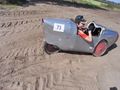
| − | Image:2008-09-20 52 5-RES02769.JPG| | + | Image:2008-09-20 52 5-RES02769.JPG|That's how an Alleweder looks from the back. |
| − | Image:2008-09-20 52 5-RES01771.JPG| | + | Image:2008-09-20 52 5-RES01771.JPG|People in a canoe in a canal. |
| − | Image:2008-09-20 52 5-RES01774.JPG| | + | Image:2008-09-20 52 5-RES01774.JPG|Rallycar that needed new front tires. |
| − | Image:2008-09-20 52 5-RES01775.JPG| | + | Image:2008-09-20 52 5-RES01775.JPG|Other rallycar (reminding Arvid of NFS). |
| − | Image:2008-09-20 52 5-RES01776.JPG| | + | Image:2008-09-20 52 5-RES01776.JPG|After a wrong turn. |
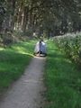
| − | Image:2008-09-20 52 5-RES02777.JPG| | + | Image:2008-09-20 52 5-RES02777.JPG|Special cycling road through nature park. |
| − | Image:2008-09-20 52 5-RES01778.JPG| | + | Image:2008-09-20 52 5-RES01778.JPG|Holterberg view. |
| − | Image:2008-09-20 52 5-RES01779.JPG| | + | Image:2008-09-20 52 5-RES01779.JPG|Holterberg view 2. |
| − | + | Image:2008-09-20 52 5-RES01781.JPG|Weird guy on the Holterberg. | |
| − | Image:2008-09-20 52 5-RES01781.JPG| | + | Image:2008-09-20 52 5-RES01782.JPG|More nice backroads. |
| − | Image:2008-09-20 52 5-RES01782.JPG| | + | Image:2008-09-20 52 5-RES01783.JPG|Arvid needed to step off his bike to get through this. |
| − | Image:2008-09-20 52 5-RES01783.JPG| | + | Image:2008-09-20 52 5-RES01784.JPG|Not that it was a lot better here. |
| − | Image:2008-09-20 52 5-RES01784.JPG| | + | Image:2008-09-20 52 5-RES02785.JPG|"I am stuck!" |
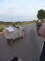
| − | Image:2008-09-20 52 5-RES02785.JPG| | + | Image:2008-09-20 52 5-RES02786.JPG|The benefits of 3 wheels. |
| − | Image:2008-09-20 52 5-RES02786.JPG| | + | Image:2008-09-20 52 5-RES01787.JPG|Canal, cycling path, unpaved road, cows. |
| − | Image:2008-09-20 52 5-RES01787.JPG| | + | Image:2008-09-20 52 5-RES01788.JPG|Ok ok, there might be some benefits to having an extra wheel. |
| − | Image:2008-09-20 52 5-RES01788.JPG| | + | Image:2008-09-20 52 5-RES01789.JPG|The damage. |
| − | Image:2008-09-20 52 5-RES01789.JPG| | + | Image:2008-09-20 52 5-RES01790.JPG|Bridge over the IJssel-river. |
| − | Image:2008-09-20 52 5-RES01790.JPG| | + | Image:2008-09-20 52 5-RES01791.JPG|Closing in on it. |
| − | Image:2008-09-20 52 5-RES01791.JPG| | + | Image:2008-09-20 52 5-RES01792.JPG|Watchtower Ketelmeer-east-sign. |
| − | Image:2008-09-20 52 5-RES01792.JPG| | + | Image:2008-09-20 52 5-RES01796.JPG|Parking spot&watchtower on the dyke. |
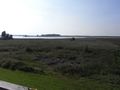
| − | Image:2008-09-20 52 5-RES01796.JPG| | + | Image:2008-09-20 52 5-RES01797.JPG|Hash is around there. |
| − | Image:2008-09-20 52 5-RES01797.JPG| | + | Image:2008-09-20 52 5-RES01798.JPG|More pictures from the watchtower. |
| − | Image:2008-09-20 52 5-RES01798.JPG| | + | Image:2008-09-20 52 5-RES01799.JPG|More pictures from the watchtower. |
| − | Image:2008-09-20 52 5-RES01799.JPG| | + | Image:2008-09-20 52 5-RES01800.JPG|Hashpoint is closer to the trees. |
| − | Image:2008-09-20 52 5-RES01800.JPG| | + | Image:2008-09-20 52 5-RES01801.JPG|The problem getting to the hash. |
| − | Image:2008-09-20 52 5-RES01801.JPG| | + | Image:2008-09-20 52 5-RES01802.JPG|2 GPS'es. |
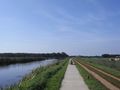
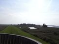
| − | Image:2008-09-20 52 5-RES01802.JPG| | + | Image:2008-09-20 52 5-RES01803.JPG|The dyke. |
| − | Image:2008-09-20 52 5-RES01803.JPG| | + | Image:2008-09-20 52 5-RES02804.JPG|Time&date. |
| − | Image:2008-09-20 52 5-RES02804.JPG| | + | Image:2008-09-20 52 5-RES02807.JPG|Alleweder-rider. |
| − | Image:2008-09-20 52 5-RES02807.JPG| | + | Image:2008-09-20 52 5-RES02808.JPG|Arvid (&watchtower) |
| − | Image:2008-09-20 52 5-RES02808.JPG| | + | Image:2008-09-20 52 5-RES02809.JPG|Long shadows. |
| − | Image:2008-09-20 52 5-RES02809.JPG| | + | Image:2008-09-20 52 5-RES01811.JPG|Evening view on Holterberg. |
| − | Image:2008-09-20 52 5-RES01811.JPG| | + | Image:2008-09-20_52_5-RES01814.JPG|Arvid after arriving home. |
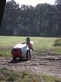
| − | Image:2008-09-20_52_5-RES01814.JPG| Arvid after arriving home. | ||
</gallery> | </gallery> | ||
Revision as of 06:55, 21 September 2008
| Sat 20 Sep 2008 in 52,5: 52.5939233, 5.8365649 geohashing.info google osm bing/os kml crox |
Plan
Arvid will attempt it. And found someone to cycle along. It's about 100km one way, and we made the route a bit more interesting by putting the only hill of the province in it.
Achievements
- Mother Nature's Bitch, and still doubting if a boat would've helped, or that it was inaccessible anyway because there would be a lot of reed, making it more a There Might be Alligators!
- Cycled 236.9km.
- Dragged along another recumbent rider.
Expedition
Around 9:30 Arvid and the fellow recumbent rider(riding an Alleweder) met at the main university campus entrance. They weren't going to take the easy route to Kampen, oh no. They would conquer every possible hill(all three of them!, one with 10%) that could reasonably fit in the route. Making the route about 15-20km longer than necessary. Along the way they found there was a rally going on just next to the main road they followed.
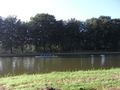
Around xxxx they reached the point on the road closest to the hash, which was a dead end with a birdviewerstower. Arvid kind of expected a place like that, although it doesnt exist on google maps. It has a view over the unused land on the outside of the dyke and over the Ketelmeer(kettle-lake).
It also gave them a view in the direction of the hashpoint. Neither of the geohashers printed the google-maps view, so Arvid really tried to remember what it looked like. Google maps shows there is a field in use on the outside of the dyke, and the hash is at the edge of that. There was no in-use field anymore. It looked like new waterways were digged, and the area was given back to nature. Which meant they couldn't get any closer than about 100m from the hash. The trees that google shows are still there, but there is no way you could walk easily to that. Arvid remembered the people taking an inflatable boat with them. But it was no use. The water wasn't deep, but even if he'd walked through it, the hashpoint might just be between the reed, so inaccessable anyway.
Just after 16:00 those recumbentriders started on the journey home. Their average speed had gone down, mostly since Arvid had trouble keeping his pace up. But they also stopped a lot less and didn't make as much mistakes as they made on the way to the hash. They arrived home around 22:45.
Early in the morning it was still cold.
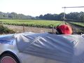
That's how an Alleweder looks from the back.
People in a canoe in a canal.
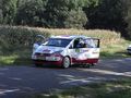
Rallycar that needed new front tires.
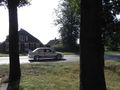
Other rallycar (reminding Arvid of NFS).
After a wrong turn.
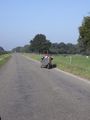
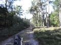
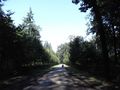
Special cycling road through nature park.
Holterberg view.
Holterberg view 2.
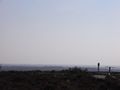
Weird guy on the Holterberg.
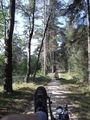
More nice backroads.
Arvid needed to step off his bike to get through this.
Not that it was a lot better here.
"I am stuck!"
The benefits of 3 wheels.
Canal, cycling path, unpaved road, cows.
Ok ok, there might be some benefits to having an extra wheel.
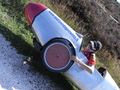
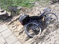
The damage.
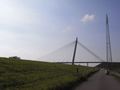
Bridge over the IJssel-river.
Closing in on it.
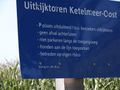
Watchtower Ketelmeer-east-sign.
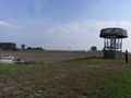
Parking spot&watchtower on the dyke.
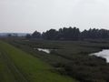
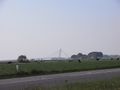
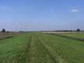
Hash is around there.
More pictures from the watchtower.
More pictures from the watchtower.
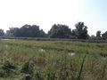
Hashpoint is closer to the trees.
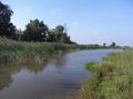
The problem getting to the hash.
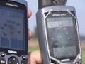
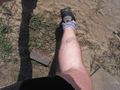
2 GPS'es.
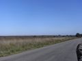
The dyke.
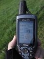
Time&date.
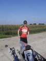
Alleweder-rider.
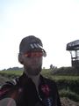
Arvid (&watchtower)
Long shadows.
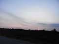
Evening view on Holterberg.
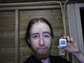
Arvid after arriving home.


