Difference between revisions of "2009-07-16 40 -74"
From Geohashing
imported>Jevanyn (→Photos) |
imported>Jevanyn m (→Photos) |
||
| Line 23: | Line 23: | ||
<gallery perrow="3"> | <gallery perrow="3"> | ||
Image:DsZ-IGGCir3RmHadbiFTTI-large.jpg | Last sign of civilization | Image:DsZ-IGGCir3RmHadbiFTTI-large.jpg | Last sign of civilization | ||
| − | Image:DiMRC-GCir3P3badbiFPIU-large.jpg | Unfortunately, | + | Image:DiMRC-GCir3P3badbiFPIU-large.jpg | Unfortunately, it does not say "Bridge Club Ahead" |
Image:DB9lDeGCir3QY8adbiFPIU-large.jpg | A spooky house! A spooky house! | Image:DB9lDeGCir3QY8adbiFPIU-large.jpg | A spooky house! A spooky house! | ||
Image:DwLrGwGCir3PL4adbiFPIU-large.jpg | ZOMG WHAT IS THAT?!? RUN! MUST WARN OTHERS!! | Image:DwLrGwGCir3PL4adbiFPIU-large.jpg | ZOMG WHAT IS THAT?!? RUN! MUST WARN OTHERS!! | ||
Revision as of 14:36, 25 September 2009
| Thu 16 Jul 2009 in 40,-74: 40.8846973, -74.9212991 geohashing.info google osm bing/os kml crox |
Location
- Shades of Death Road, Marble Hill, NJ.
Participants
- Jevanyn, at about 10:30PM
Plans
I went to a friend's barbecue that evening, which meant I was about halfway there already. I called up directions on Windows Live Maps on my Motorola Q, and off I went.
Expedition
TBD
Photos
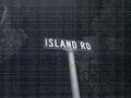
Last sign of civilization
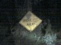
Unfortunately, it does not say "Bridge Club Ahead"
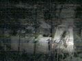
A spooky house! A spooky house!
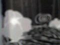
ZOMG WHAT IS THAT?!? RUN! MUST WARN OTHERS!!


