Difference between revisions of "2009-09-01 39 -105"
From Geohashing
imported>Cedarm m (Replacing page with '{{subst:Expedition |lat = 39 |lon = -105 |date = 2009-09-01 }}') |
imported>Cedarm |
||
| Line 1: | Line 1: | ||
| − | |||
| − | |||
<!-- | <!-- | ||
[[Image:{{{image|IMAGE}}}|thumb|left]] | [[Image:{{{image|IMAGE}}}|thumb|left]] | ||
| Line 8: | Line 6: | ||
| lon=-105 | | lon=-105 | ||
| date=2009-09-01 | | date=2009-09-01 | ||
| + | | graticule_name=Denver, Colorado | ||
| + | | graticule_link=Denver, Colorado | ||
}} | }} | ||
| Line 13: | Line 13: | ||
__NOTOC__ | __NOTOC__ | ||
== Location == | == Location == | ||
| − | + | Next to a new lake in Arvada, Colorado. | |
== Participants == | == Participants == | ||
| − | + | [[User:CedarM | Cedar Myers]] | |
== Plans == | == Plans == | ||
| − | + | On a whim I decided to go after work. | |
== Expedition == | == Expedition == | ||
| + | [[Image:2009-09-01 39 -105 topo.JPG | thumb | left | topo map]] | ||
| + | [[Image:2009-09-01 39 -105 satellite.JPG | thumb | left | satellite photo]] | ||
| + | Nothing to see here. It seems a new lake was created, likely a new neighborhood with land to be sold as lakefront property, but right now it's construction access only. Compare the current topo map with the satellite photo. | ||
| − | + | They already have the new road paved with bicycle lane and speed limit signs up. | |
| − | + | {{-}} | |
== Photos == | == Photos == | ||
| − | |||
| − | |||
| − | |||
| − | |||
| − | |||
| − | |||
<gallery perrow="3"> | <gallery perrow="3"> | ||
| − | + | Image:2009-09-01 39 -105 no1.JPG | No Entry. | |
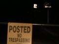
| + | Image:2009-09-01 39 -105 no2.JPG | No Entry again. | ||
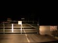
| + | Image:2009-09-01 39 -105 no2b.JPG | speed limit and bicycle lane signs | ||
</gallery> | </gallery> | ||
| − | |||
| − | |||
| − | |||
| − | |||
| − | |||
| − | |||
| − | |||
[[Category:Expeditions]] | [[Category:Expeditions]] | ||
| − | |||
[[Category:Expeditions with photos]] | [[Category:Expeditions with photos]] | ||
| − | |||
| − | |||
| − | |||
| − | |||
| − | |||
| − | |||
| − | |||
| − | |||
| − | |||
[[Category:Coordinates not reached]] | [[Category:Coordinates not reached]] | ||
| − | |||
| − | |||
[[Category:Not reached - No public access]] | [[Category:Not reached - No public access]] | ||
| − | |||
| − | |||
| − | |||
Revision as of 19:48, 8 September 2009
| Tue 1 Sep 2009 in Denver, Colorado: 39.8609535, -105.1742303 geohashing.info google osm bing/os kml crox |
Location
Next to a new lake in Arvada, Colorado.
Participants
Plans
On a whim I decided to go after work.
Expedition


Nothing to see here. It seems a new lake was created, likely a new neighborhood with land to be sold as lakefront property, but right now it's construction access only. Compare the current topo map with the satellite photo.
They already have the new road paved with bicycle lane and speed limit signs up.
Photos
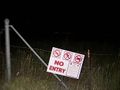
No Entry.
No Entry again.
speed limit and bicycle lane signs


