Difference between revisions of "2009-10-18 33 -84"
imported>NWoodruff (→NWoodruff) |
imported>NWoodruff (→NWoodruff) |
||
| Line 20: | Line 20: | ||
=== [[User:NWoodruff|NWoodruff]] === | === [[User:NWoodruff|NWoodruff]] === | ||
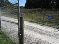
| − | I drove out to his hash point and followed Google directions. the last turn on to the dirt road has a big gated fence in front of it. There are many signs posted for no trespassing. I hopped out and took a few pictures | + | I drove out to his hash point and followed Google directions. the last turn on to the dirt road has a big gated fence in front of it. There are many signs posted for no trespassing. I hopped out and took a few pictures. 0.30 of a mile is as close as I could get. |
I drove down the road for a little bit because I saw on the map that there is another dirt road that leads to the hash spot. I found the road and started to drive down it. I came up on another "Authorized vehicles" sign. I kept driving. I then came up on the big gate fence. The gate was open. But, with the number of "No Trespassing" signs that were posted on it, I decided that I was not going to get to the hash point. I hopped out and took a few picture. | I drove down the road for a little bit because I saw on the map that there is another dirt road that leads to the hash spot. I found the road and started to drive down it. I came up on another "Authorized vehicles" sign. I kept driving. I then came up on the big gate fence. The gate was open. But, with the number of "No Trespassing" signs that were posted on it, I decided that I was not going to get to the hash point. I hopped out and took a few picture. | ||
Revision as of 14:01, 19 October 2009
| Sun 18 Oct 2009 in Atlanta: 33.4945374, -84.2894258 geohashing.info google osm bing/os kml crox |
Graticule
About
On a big open field on Clayton County public water property.
Expedition
NWoodruff
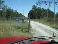
I drove out to his hash point and followed Google directions. the last turn on to the dirt road has a big gated fence in front of it. There are many signs posted for no trespassing. I hopped out and took a few pictures. 0.30 of a mile is as close as I could get.
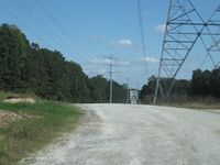
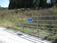
I drove down the road for a little bit because I saw on the map that there is another dirt road that leads to the hash spot. I found the road and started to drive down it. I came up on another "Authorized vehicles" sign. I kept driving. I then came up on the big gate fence. The gate was open. But, with the number of "No Trespassing" signs that were posted on it, I decided that I was not going to get to the hash point. I hopped out and took a few picture.
I then called it a day and drove back to Norcross.
Gallery
- Photo Gallery
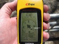
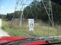
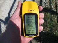
0.3 miles to go. Not close enough.
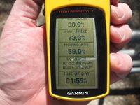
Time of the almost meetup.
Date of the almost meetup.
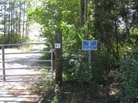
The reason for the almost meetup, the dreaded "No Trespassing" sign.
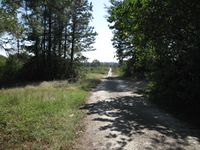
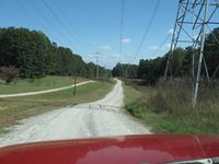
So close, yet so far away. The hash point is down there somewhere.
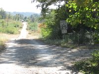
Authorized vehicles only...
There is another road that leads down to the hash point.
The other road that I wanted to take a look down.
The dreaded authorized vehicles only. But there is no gate or anything.
This looks promising.
Well, except there is a gate here with another "No Trespassing" sign. The gate is open and I bet there isn't a soul around for miles.
The open gate.
The multiple locks were all unlocked, not broken open.

2.31 miles to go. Not close enough.
The time of when I gave up on trying to reach the Geohash spot.


