Difference between revisions of "2010-01-31 42 -88"
imported>Mrmoses (added location, plans, participant, and category: planning) |
imported>Mrmoses (added pictures and tracklog) |
||
| Line 24: | Line 24: | ||
Go to the hashpoint sometime in the afternoon. | Go to the hashpoint sometime in the afternoon. | ||
| − | |||
| − | |||
== Expedition == | == Expedition == | ||
| − | == Tracklog == | + | == [http://maps.google.com/maps/ms?ie=UTF8&hl=en&msa=0&msid=109316342448012701002.00047e7b8b1c7dac7ac80&t=h&z=12 Tracklog]== |
| − | + | Here is a screenshot of the tracklog near the hashpoint. I came from the west, turned south, went past the path, came back north, parked in the restaurant parking lot, walked south to the path, took path to hashpoint, then back to my car, and home. Click the image to view the full track log. | |
| + | [[File:2010-01-31 42 -88 Tracklog screenshot.png|left|650px|link=http://maps.google.com/maps/ms?ie=UTF8&hl=en&msa=0&msid=109316342448012701002.00047e7b8b1c7dac7ac80&t=h&z=12]] | ||
| + | <br style="clear: both;" /> | ||
| − | |||
| − | |||
| − | + | == Photos == | |
<gallery perrow="4"> | <gallery perrow="4"> | ||
| − | Image: | + | Image:2010-01-31 42 -88 path.jpg|the path i took to the hashpoint |
| − | Image: | + | Image:2010-01-31 42 -88 junk yard.jpg|junk yard along the path |
| + | Image:2010-01-31 42 -88.jpg|bike tracks, shoe traks, and dog tracks (i think maybe somebody was chasing their dog because their dog was chasing someone on a bike?) | ||
| + | Image:2010-01-31 42 -88 path2.jpg|path again (from the inside!!) | ||
| + | Image:2010-01-31 42 -88 junk card tower.jpg|in the distance is a tower of crushed cars in the junk yard | ||
| + | Image:2010-01-31 42 -88 nest.jpg|im glad the hashpoint wasn't in there | ||
| + | Image:2010-01-31_42_-88_at_hash.jpg|at the hashpoint | ||
| + | Image:2010-01-31 42 -88 winter flowers.jpg|flowers in the winter | ||
| + | Image:2010-01-31 42 -88 tree post.jpg|a tree post | ||
| + | Image:2010-01-31 42 -88 winter flowers close.jpg|close up of wintery flowers | ||
| + | Image:2010-01-31 42 -88 lots of wintery flowers.jpg|lots of wintery flowers | ||
| + | Image:2010-01-31 42 -88 sun trees.jpg|the sun through the trees | ||
| + | Image:2010-01-31 42 -88 path road.jpg|the path back to the road (you can see the ice that I slide on in the video) | ||
| + | Image:2010-01-31 42 -88 junk yard fence.jpg|junk yard fence | ||
| + | Image:2010-01-31 42 -88 frozen.jpg|frozen near the junkyard fence | ||
</gallery> | </gallery> | ||
| − | |||
Revision as of 21:33, 31 January 2010
| Sun 31 Jan 2010 in 42,-88: 42.3697908, -88.8551778 geohashing.info google osm bing/os kml crox |
Location
In the middle of some trees off of a prairie trail going through some cornfields.
Participants
Plans
Go to the hashpoint sometime in the afternoon.
Expedition
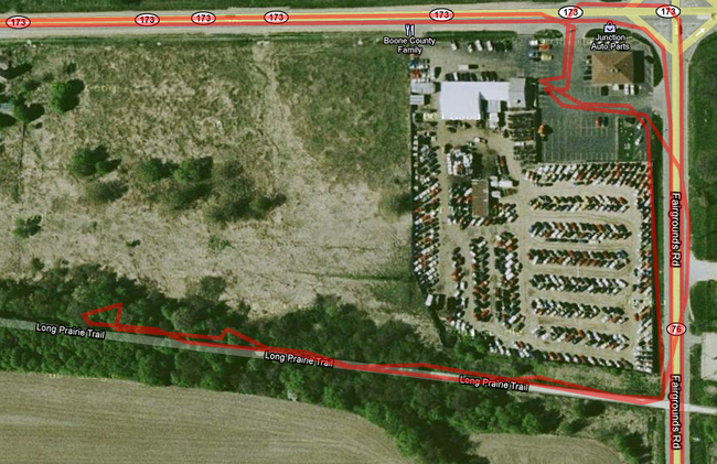
Tracklog
Here is a screenshot of the tracklog near the hashpoint. I came from the west, turned south, went past the path, came back north, parked in the restaurant parking lot, walked south to the path, took path to hashpoint, then back to my car, and home. Click the image to view the full track log.
Photos
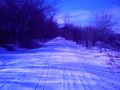
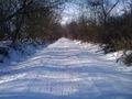
the path i took to the hashpoint
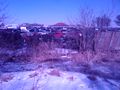
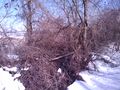
junk yard along the path
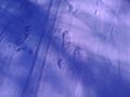
bike tracks, shoe traks, and dog tracks (i think maybe somebody was chasing their dog because their dog was chasing someone on a bike?)
path again (from the inside!!)
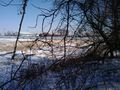
in the distance is a tower of crushed cars in the junk yard
im glad the hashpoint wasn't in there
at the hashpoint
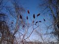
flowers in the winter
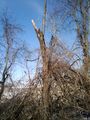
a tree post
close up of wintery flowers
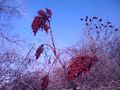
lots of wintery flowers
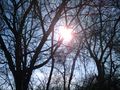
the sun through the trees
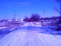
the path back to the road (you can see the ice that I slide on in the video)
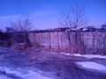
junk yard fence
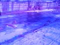
frozen near the junkyard fence


