Difference between revisions of "2010-05-06 45 -123"
imported>Jiml (Finally upload picture) |
imported>FippeBot m (Location) |
||
| (One intermediate revision by one other user not shown) | |||
| Line 1: | Line 1: | ||
| − | |||
| − | |||
| − | |||
| − | |||
| − | |||
| − | |||
{{meetup graticule | {{meetup graticule | ||
| lat=45 | | lat=45 | ||
| Line 11: | Line 5: | ||
}} | }} | ||
| − | |||
__NOTOC__ | __NOTOC__ | ||
== Location == | == Location == | ||
| − | |||
Near North Plains, Oregon: about 100 feet into a field south of Zion Church Road, close to Highway 26. | Near North Plains, Oregon: about 100 feet into a field south of Zion Church Road, close to Highway 26. | ||
== Participants == | == Participants == | ||
| − | |||
* [[User:Jiml|Jim]] is thinking strongly of going | * [[User:Jiml|Jim]] is thinking strongly of going | ||
== Plans == | == Plans == | ||
| − | |||
Well, maybe I'll program the GPS before I go, I guess I could print out a Google map, but since I know the | Well, maybe I'll program the GPS before I go, I guess I could print out a Google map, but since I know the | ||
| Line 29: | Line 19: | ||
== Expedition == | == Expedition == | ||
| − | |||
| − | + | My first pass at getting to the point was to go to Zion Church Road. The spot was off in a field, | |
| − | and I | + | so I stopped at a nearby house and asked who might own that field. They directed me a ways down |
| + | Glencoe Road. | ||
| + | |||
| + | So, I headed down there, and followed my GPS to attempt to get to the spot from the South. I | ||
| + | found another person to ask, and explained what I was doing and where I wanted to go. They weren't | ||
| + | too sure where I was talking about, and I wasn't certain either, since I was now about a | ||
| + | half mile south of the hashpoint and it was less clear which crop was around the hashpoint from | ||
| + | that distance. | ||
| + | |||
| + | They directed me towards someone else, but we started talking about other things, including | ||
| + | the history of the area, and various farm discussions like the installation of wells and | ||
| + | field drainage. It turns out that he knows who installed the drainage into area | ||
| + | many years ago. A useful tidbit of information to have! | ||
| + | |||
| + | I said goodbye and headed to the last stop, but no one was home. | ||
| + | So, I gave up and went home. | ||
| Line 51: | Line 55: | ||
[[Category:Coordinates not reached]] | [[Category:Coordinates not reached]] | ||
[[Category:Not reached - No public access]] | [[Category:Not reached - No public access]] | ||
| + | {{location|US|OR|WI}} | ||
Latest revision as of 01:54, 9 August 2019
| Thu 6 May 2010 in 45,-123: 45.5724846, -123.0061930 geohashing.info google osm bing/os kml crox |
Location
Near North Plains, Oregon: about 100 feet into a field south of Zion Church Road, close to Highway 26.
Participants
- Jim is thinking strongly of going
Plans
Well, maybe I'll program the GPS before I go, I guess I could print out a Google map, but since I know the area, it doesn't seem necessary. Getting permission might be tricky. As might be parking.
Expedition
My first pass at getting to the point was to go to Zion Church Road. The spot was off in a field, so I stopped at a nearby house and asked who might own that field. They directed me a ways down Glencoe Road.
So, I headed down there, and followed my GPS to attempt to get to the spot from the South. I found another person to ask, and explained what I was doing and where I wanted to go. They weren't too sure where I was talking about, and I wasn't certain either, since I was now about a half mile south of the hashpoint and it was less clear which crop was around the hashpoint from that distance.
They directed me towards someone else, but we started talking about other things, including the history of the area, and various farm discussions like the installation of wells and field drainage. It turns out that he knows who installed the drainage into area many years ago. A useful tidbit of information to have!
I said goodbye and headed to the last stop, but no one was home.
So, I gave up and went home.
Photos
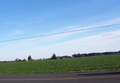
View of the hashpoint
