Difference between revisions of "2010-06-02 49 -122"
From Geohashing
imported>MistStlkr |
imported>MistStlkr |
||
| Line 9: | Line 9: | ||
== Photos == | == Photos == | ||
| − | {{Gallery | height= | + | {{Gallery | height=120 | lines=1 |
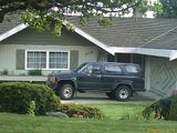
| File:IMAG0214.jpg|[[2010-06-02 49 -122|A photo of the house showing the street number]] | | File:IMAG0214.jpg|[[2010-06-02 49 -122|A photo of the house showing the street number]] | ||
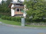
| File:IMAG0216.jpg|[[2010-06-02 49 -122|... and the nearest intersection with time stamps within the same minute.]] | | File:IMAG0216.jpg|[[2010-06-02 49 -122|... and the nearest intersection with time stamps within the same minute.]] | ||
Revision as of 05:57, 3 June 2010
Contents
Location
According to Google Maps, the location was "5320-5550 Monarch St, Burnaby, BC V5G 1Z9, Canada". Without a GPS unit I can not get more specific than using this information. My first geohash took me less than a kilometer out of the way from my daily commute. Rough expedition, that. :-D
Participants
Plans
Cut out of work early and swing by on the way home while there is still daylight, and hope it isn't in a gated community or something. Also, be thankful I'm not still in the redneck part of the world where taking a photo of someone's home like this might be answered with a shotgun. Hooray Canada!!!!

