Difference between revisions of "2010-08-21 67 25"
From Geohashing
imported>Isopekka (→Expedition) |
imported>Isopekka (→Photos) |
||
| Line 35: | Line 35: | ||
* Expedition took 5 hours | * Expedition took 5 hours | ||
* Physical efforts needed(1-5): 2 | * Physical efforts needed(1-5): 2 | ||
| + | |||
== Photos == | == Photos == | ||
Revision as of 16:55, 21 August 2010
| Sat 21 Aug 2010 in 67,25: 67.0014348, 25.7931139 geohashing.info google osm bing/os kml crox |
Location
About 60 km north of Rovaniemi, in wilderness. Can be almost reached by car.
Participants
isopekka with wife, son and dog.
Expedition
After driving about 90 km my wife and son decided to enjoy the nature in wilderness. So I had to continue driving alone still about 2 km. To the hashpoint I had to walk 800 m. At hashpoint I was at 15:00 p.m. Silence in wilderness was perfect. After hash-documentation I found my family really enjoying outdoor life.
- By car total 188 km
- Walking total 1.6 km
- Expedition took 5 hours
- Physical efforts needed(1-5): 2
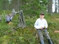
Photos
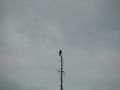
The Owl (Surnia ulula?)
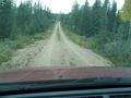
Still 2 km to drive
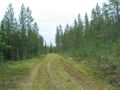
...and 800 m to walk
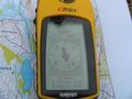
Exactly at the latitude N67
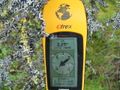
The proof
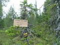
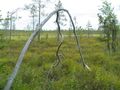
The hashpoint tree
View from the hashpoint
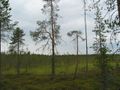
Another view from the hashpoint
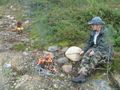
Enjoying the nature
...and hunting
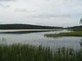
Kunettijärvi, a nice wilderness lake near the hashpoint


Achievements
isopekka achieved level 2 of the Minesweeper Geohash achievement
|